
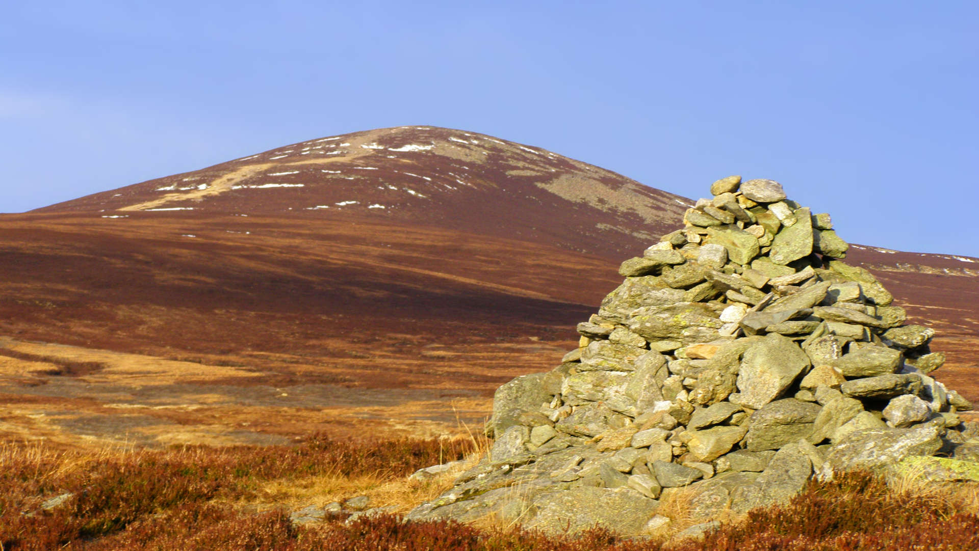
Mount Keen from Glen Mark
Biking and hiking route up Mount Keen from Glen Mark and Glen Esk
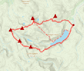
This is the most popular route up Mount Keen and begins along estate tracks through Glen Mark on which the use of a bike is recommended. Higher up well maintained paths make for a straightforward route to Mount Keen's summit.
Route outline
| Munros | ||||
| Walk ascent | 250m (820ft) | |||
| distance | 3km (2m) | |||
| time | 1:00hr | |||
| Bike ascent | 450m (1470ft) | |||
| distance | 13km (8m) | |||
| time | 1:30hr | |||
| Start/finish | Invermark car-park Grid Ref : NO447804 | |||
| Terrain |
| |||
| Nav |
| |||
| Effort |
| |||
| Scenery |
| |||


The most popular route up Mount Keen travels through Glen Mark and begins from Glen Esk to the south. Like the the longer Glen Tanar route that heads in from the north, most of the way is on fine estate tracks with well maintained paths higher up. Queen's Well is worth the short de-tour from the track. This route is one of the easier Munro routes !
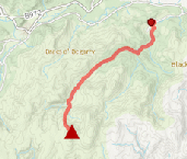
Show map
Route description
1. Getting to Glen Mark

Invermark Castle
Just outside of Brechin, which is on the A90 between Aberdeen and Dundee, the B966 heads northwards to the picturesque village of Edzell. North of this village, an unclassified road travels around 20km up Glen Esk and ends by a car-park near Loch Lee and at the opening to Glen Mark.
2. The Queen's Well and Glenmark

Queen's Well
This route is described as a bike-and-hike, but its done just as easily, if more relaxed, as a walk !
Leave the car-park and head westwards, cross a bridge over the Burn of Branny, pass a church  , then just before the bridge over River Mark, turn right up a track. The track comes to a house, turn left just before it and head through a gate and cycle up through some woodland.
You'll come to a large and and old gate  through a deer fence. The fence either side of the gate is electric - it was live last time I visited !
Through the gate and over a burn, follow the estate track for 1.5km to a junction  . To the left is a possible return route that meets the ruins of Invermark Castle, though this is discouraged by a sign !
Keep right at the junction and continue towards the house at Glenmark, on the way have a look at the Queens Well  and throw some pennies for luck. Up to the house at Glenmark
  , if you don't have thighs of steel or an e-bike, best to leave bikes here - it's uphill next !
3. Mount Keen

Final approach to Mount Keen's summit
Beyond the house at Glenmark, two burns require crossing - Easter Burn and Ladder Burn. In most conditions these burns are straightforward to cross, but in spate they can present some difficulty, Ladder Burn in particular. It is possible to keep to the east of these burns and climb uphill, but there is a lot of beating through heather to pregress.
Once across the burns, head uphill on the track for just over 2km to a cairn at c670m  . The cairn marks the start of a well constructed path which continues directly to Mount Keen's summit just under 2km away. Just before reaching the summit is an interesting boulder with a 'B' engraved - the 'boundary stone' - the 'B' faces north, so you might not see it until on the return ! A trig point rests on Mount Keen's summit
  from where views are far and uninterupted.
4. Return

The 'boundary' stone near Mount Keen's summit
Return by the same route, possibly detouring onto the track above the southern bank of Water of Mark to visit the remains of Invermark Castle.
Route profile »

Maps and GPX downloads »

|
Download GPX of route |
Information on maps and GPX files is on this page.
The map images above link to items on Amazon. A small commission is earned on any map purchased which helps fund the operating costs of this website.
Weather forecasts »
| Regional | MWIS - Southeast Highlands |
| Peak specific | Mountain Forecast.com Met Office YR.no |
| Seasonal | SAIS - Southern Cairngorms Midge forecast |
Alternative and nearby routes »
Mount Keen from Glen Tanar | |
|
Fine tracks following the old drove road through forests of Scots Pine lead to the "Mounth Road" and to Mount Keen's summit. The use of a bike for the 13km plus cycle to the foot of Mount Keen is recommended ! Peaks : 1 Munro
Ascent : 810m (2660ft) Distance : 31km (19m) Time : 3:30hr |
Mount Battock from Glen Esk | |

|
A circular hike on estate tracks and following fence-lines makes for a fairly direct, if rather unexciting route to Mount Battock. Peaks : 1 Corbett
Ascent : 675m (2210ft) Distance : 14km (9m) Time : 4:40hr |
Lochnagar and Loch Muick circuit | |
|
A group of five Munros surround Loch Muick in Royal Deeside. Including mighty Lochnagar, these peaks form a terrific high-level hiking circuit. Peaks : 5 Munros, 1 Corbett
Ascent : 1340m (4400ft) Distance : 28km (17m) Time : 9:15hr |
Driesh and Mayar | |

|
North of Forfar and Kirriemuir, Jock's Road runs along The Angus Glens towards Braemar. Overlooking this old drove road are the Munro twins of Driesh and Mayar, two rolling hills with fine paths that make for an easy afternoon's hillwalk. Peaks : 2 Munros
Ascent : 900m (2950ft) Distance : 14km (9m) Time : 5hr |


