
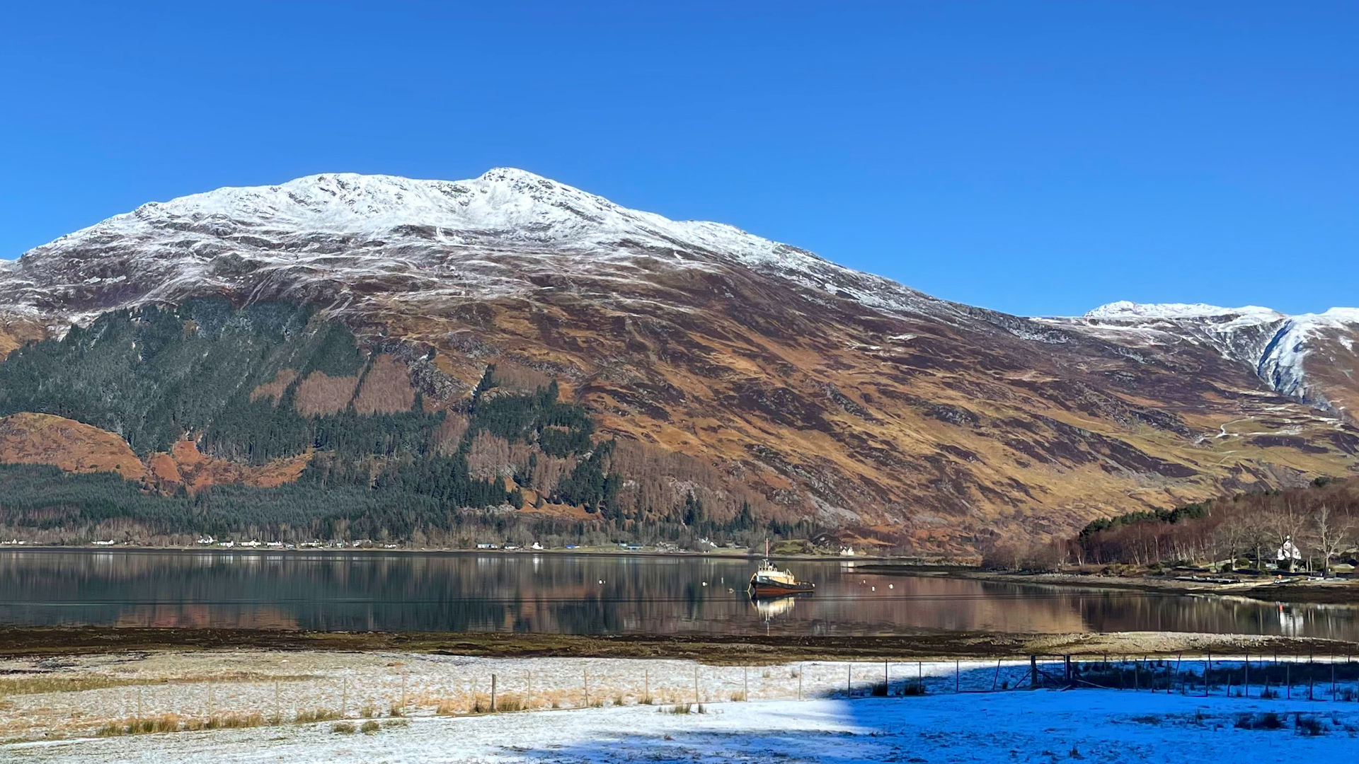
Sgurr an Airgid from Morvich
Hillwalking route up Sgurr an Airgid from the head of Loch Duich
An old estate track and a rough path lead up from Clachan Duich by the head of Loch Duich to the summit of Sgurr an Airgid, a quiet spot from where to appreciate sensational views.
Route outline
| Corbetts | ||||
| Ascent | 830m (2720ft) | |||
| Distance | 9km (6m) | |||
| Time | 3:35hr | |||
| Start/finish | Clachan Duich Grid Ref : NG947212 | |||
| Terrain |
| |||
| Nav |
| |||
| Effort |
| |||
| Scenery |
| |||


From the narrow old Strath Croe road, by the head of Loch Duich, stands a war memorial overlooking Clachan Duich graveyard. From here, an old estate track trundles its way up much of Sgurr an Airgid's south-facing slopes. Higher up a rough path takes over from the track and leads around the back of Sgurr an Airgid's eastern shoulder and to its summit where a trig point stands from where to take in stunning views.
Show map
Route description
1. Getting to Clachan Duich

Clachan Duich graveyard
The A87 travels from Invergarry in the Great Glen, north west onto Kyle of Lochalsh and the Isle of Skye. As it descends through Glen Shiel and meets with the head of Loch Duich, the road turns and Sgurr an Airgid is in full view directly ahead.
The road crosses an inlet via a causeway at the western end of Strath Croe, at the northern side of which is junction with a narrow road marked to Morvich. Just beyond the junction is the Clachan Duich burial ground, above which a war memorial looks over.
The route up Sgurr an Airgid begins from here where there is ample parking on rough ground by the roadside.
2. Sgurr an Airgid

On the path up Sgurr an Airgid by the gate at 300m
From Clachan Duich, head through a gate by the northern side of the road into birch woodland. A rough and rather soggy track leads a way through the woodland, turns north-east and begins climbing uphill.
After a twist and turn, the track becomes somewhat drier as it settles into a gradual ascent on grass-covered hillside. As you climb, look back occasionally as the developing view over Loch Duich and Sgurr Mhic Bharraich to Beinn Sgritheall and Knoydart is stunning.
Higher up, just before reaching a deer-fence  , the track ends and a rough path takes over. Through the fence, follow the path as it climbs through heather up to a height of just over 500m
  .
.
The path does climb higher aiming northwards and away from Sgurr an Airgid, so at this point, make a direct line up initially up a short steep section, then on more level ground through heather and grass for Mam na Dubharaiche, the bealach between Sgurr an Airgid and Beinn Buidhe to the east.
At the bealach, a worn boot-made trod  is picked up and followed westwards as it keeps to the right (north) of Sgurr an Airgid's bouldery eastern shoulder. Higher up, the ground steepens a bit before levelling out on the approach to the summit.

On Sgurr an Airgid's summit looking to Skye
On Sgurr an Airgid's summit looking to Skye
3. Return

Descending back to Clachan Duich
On Sgurr an Airgid's summit, about-turn and re-trace your steps back to Clachan Duich.
The first time I headed up Sgurr an Airgid, I headed directly up the southern face of the hill. This would make for a quick steep descent - it is grass-covered most of the way though a bit of route twisting and turning will be needed to avoid boulders. Lower down, the deer-fence will need crossed as there isn't a gate before a final pleasant hike returns to the track just above the gate by Clachan Duich.
Route profile »

Maps and GPX downloads »


|
Download GPX of route |
Information on maps and GPX files is on this page.
The map images above link to items on Amazon. A small commission is earned on any map purchased which helps fund the operating costs of this website.
Weather forecasts »
| Regional | MWIS - Northwest Highlands |
| Peak specific | Mountain Forecast.com Met Office YR.no |
| Seasonal | SAIS - Lochaber Midge forecast |
Alternative and nearby routes »
Sgurr Gaorsaic and Falls of Glomach | |

|
A hike into the heart of Kintail on well-defined paths leads to a circular route around the slopes of A' Ghlas Bheinn, bags the Corbett Sgurr Gaorsaic and visits the impressive Falls of Glomach. Peaks : 1 Corbett
Ascent : 1250m (4100ft) Distance : 23km (14m) Time : 7:50hr |
A' Ghlas Bheinn and Beinn Fhada | |

|
In Kintail, a hike up Strath Croe leads to the two Munros of A' Ghlas Bheinn and Beinn Fhada which stand either side of the narrow gap of Bealach an Sgairne. Peaks : 2 Munros
Ascent : 1500m (4920ft) Distance : 20km (12m) Time : 8:45hr |
Sisters of Kintail | |

|
From close to the site of the Battle of Glen Shiel, a linear hillwalking route leads along a fine ridge and over the peaks that form the famed Five Sisters of Kintail to drop to the head of Loch Duich. Peaks : 3 Munros
Ascent : 1330m (4360ft) Distance : 13km (8m) Time : 5:30hr |
Sgurr Mhic Bharraich from Shiel Bridge | |

|
A fairly short hillwalk in two parts - a fine path to a secluded lochan, followed by a hike up a grass-covered slope - leads to Sgurr Mhic Bharraich's summit cairn and some wonderful views. Peaks : 1 Corbett
Ascent : 835m (2740ft) Distance : 9km (6m) Time : 3:40hr |


