Beinn Mheadhonach
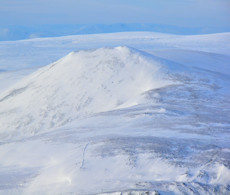
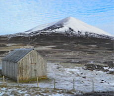
A long crest of a hill and living up to its name, Beinn Mheadhonach is sandwiched between the higher Munros of Càrn a' Chlamain and Beinn Dearg.
Beinn Mheadhonach
| Height | 900.9m |
| Prominence | 165m |
| Meaning | middle hill |
| Lists | Corbetts, 21 |
| Location | Glen Bruar to Glen Tilt, Gaick and Atholl |
| Grid Ref | NN880759 |
| Lat/Lon | 56.86094, -3.83845 |
Viewed from the A9, Beinn Mheadhonach appears conical in shape with its southern shoulder standing above Glen Tilt. It is however a rather long wide ridge stretching south-north and clad for the most part in heather and grass.
The most direct route to the base of Beinn Mheadhonach travels up Glen Tilt, with most of this on a fine estate track. Being situated between higher Beinn Dearg and Càrn a' Chlamain, a fine day can be had combining these peaks into one long hillwalking route.
Routes up Beinn Mheadhonach
Beinn Bhreac and neighbours | |

|
Hillwalking route from Glen Tilt, cycling to Beinn Dearg’s base then an off-piste loop over the summits of Beinn Mheadhonach and Beinn Bhreac. Peaks : 1 Munro, 2 Corbetts
Ascent : 1635m (5360ft) Distance : 37km (23m) Time : 9:20hr |
Beinn a' Ghlo to Beinn Dearg | |

|
A long hillwalking route over 5 Munros and a Corbett above Glen Bruar and Glen Tilt, including peaks on Beinn a’ Ghlo, Càrn a’ Chlamain and Beinn Dearg. Peaks : 5 Munros, 1 Corbett
Ascent : 2850m (9350ft) Distance : 42km (26m) Time : 15hr |
Nearby hills and mountains