
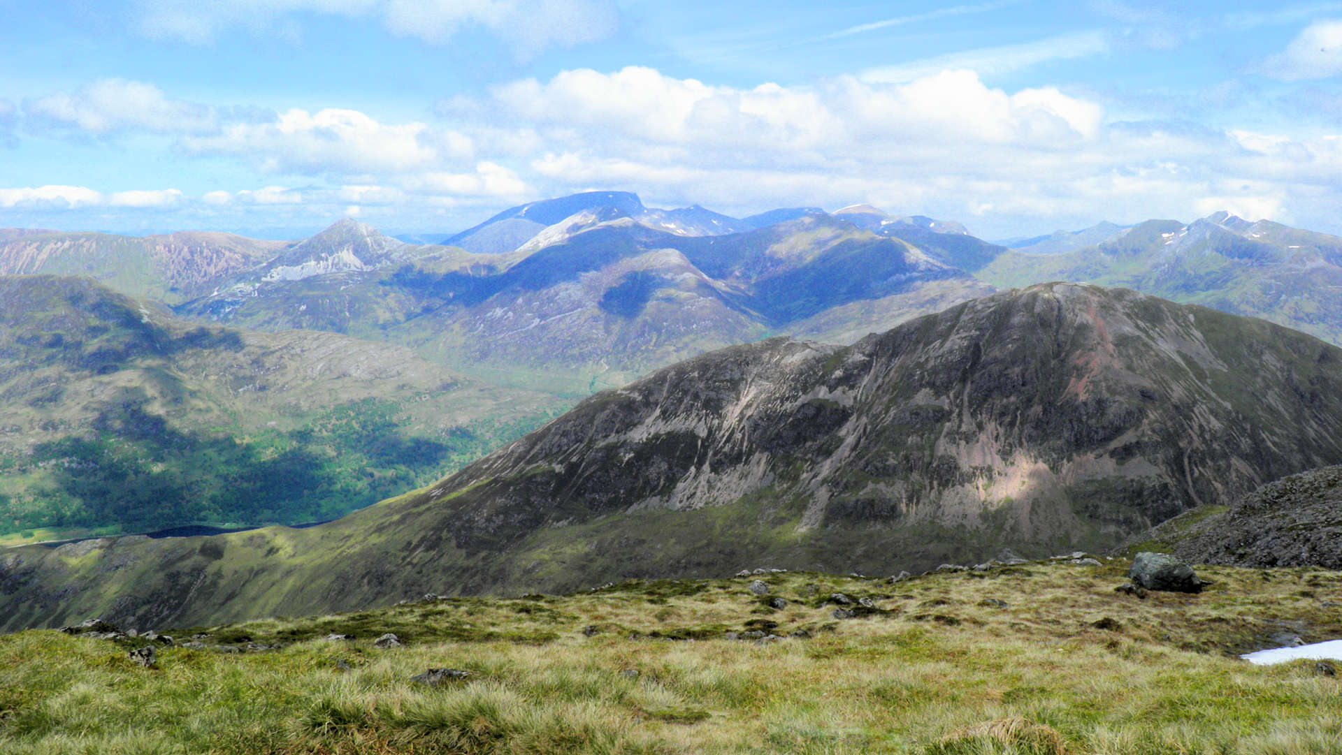
Garbh Bheinn from Loch Leven
Hillwalking route up Garbh Bheinn from Loch Leven, following wet tracks then rough slopes and boulderfield to reach the Corbett summit.
Route outline
| Corbetts | ||||
| Ascent | 840m (2750ft) | |||
| Distance | 6km (4m) | |||
| Time | 3:00hr | |||
| Start/finish | Caolasnacon, Loch Leven Grid Ref : NN097604 | |||
| Terrain |
| |||
| Nav |
| |||
| Effort |
| |||
| Scenery |
| |||


The easiest and most direct route up Garbh Bheinn is from near the campsite at Caolasnacon just above the shores of Loch Leven. The route is in two contrasting parts - a wet mucky trudge for the first 400m of ascent then a loose path on gravel thereafter.
Overall the route is very enjoyable and worthy of a fine summer evening's stroll or a short winter's daylight ramble.
Show map

Route description
1. Getting to Caolasnacon on Loch Leven

Caolasnacon and the campsite
The route starts from the east side of the bridge over the Allt Gleann a'Chaolais, just east of the Caolasnacon camping site.
There is space for 2 or 3 cars to on the west side of the bridge and space for a couple more on the east side.
Regardless of coming from the north or south, the start is most readily accessed from Glencoe Village.
2. Garbh Bheinn

Looking up Garbh Bheinn
On the eastern side of the bridge a faint wet path starts by the roadside and heads uphill through the grass and some trees. A few paces up, the path joins with tracks made by an ATV.
Follow these tracks for 50m or so, then look for a faint path on your left (perhaps marked by a few stones)  heading directly uphill. The path can be incredibly wet, boggy and slippy, but persist !
A minor summit is reached at around 400m  and the path continues south-east, ontouring around couple of rises ahead.
A wet bealach  is crossed from where the path becomes more distinct and can be seen making a route through the heather on Garbh Bheinn's steep western slope. Higher up, the path crosses through some patches of scree and zig-zags as it climbs.
Garbh Bheinn's western shoulder, Stob Coire Sgoilte  , has a few false summits, one above a landslip giving some dramatic views.

Approaching Garbh Bheinn's summit
 is a few minutes further on, where three small cairns sit overlooking drops down to Kinlochleven to the north and an interesting perspective of the Aonach Eagach's tricky ridge to the south.
Approaching Garbh Bheinn's summit
3. Return to Caolasnacon

Summit cairn of Garbh Bheinn with Blackwater reservoir beyond
About turn and return by the same route.
When reaching the bealach , a possible alternative is to head south-west and descend directly down onto the ATV track for a quick jog back to the roadside.

Looking back down over Stob Coire Sgoilte
Looking back down over Stob Coire Sgoilte
Route profile »

Maps and GPX downloads »


|
Download GPX of route |

|
Open route in OS Maps |
The map images above link to items on Amazon. A small commission is earned on any map purchased which helps fund the operating costs of this website.
Weather forecasts »
| Regional | MWIS - Western Highlands |
| Peak specific | Mountain Forecast.com Met Office YR.no |
| Seasonal | SAIS - Glencoe Midge forecast |
Alternative and nearby routes »
Aonach Eagach traverse | |

|
Aonach Eagach traverse in Glencoe is a committing scramble over Meall Dearg and Sgòrr nam Fiannaidh with exposed rocky sections and superb views. Peaks : 2 Munros
Ascent : 1200m (3940ft) Distance : 8km (5m) Time : 6hr |
Màm na Gualainn from Callert on Loch Leven | |

|
Hillwalking route up Màm na Gualainn from Callert on Loch Leven, through birch woodland then grassy slopes to a summit with wide views. Peaks : 1 Corbett
Ascent : 800m (2620ft) Distance : 6km (4m) Time : 3hr |
Eastern Mamores | |

|
Hillwalking route from Kinlochleven around the eastern Mamores, climbing Binnein Mòr and other Munros on fine stalkers paths and rough ridges. Peaks : 4 Munros, plus option of 1 Corbett
Ascent : 2000m (6560ft) Distance : 18km (11m) Time : 8hr |
Beinn a' Bheithir from Ballachulish | |

|
Hillwalking route up Sgòrr Dhearg and Sgòrr Dhonuill from Ballachulish, using forestry tracks then grassy and bouldery slopes to Munro summits. Peaks : 2 Munros
Ascent : 1300m (4270ft) Distance : 12km (7m) Time : 5:10hr |
Màm na Gualainn from the West Highland Way | |

|
Hillwalking route up Màm na Gualainn from the West Highland Way, climbing from a quiet glen over heather slopes to its grassy summit. Peaks : 1 Corbett
Ascent : 755m (2480ft) Distance : 11km (7m) Time : 4hr |


