
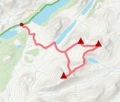
Aberarder to Roughburn
Hillwalking route up Creag Meagaidh and the Munros from Aberarder to Roughburn
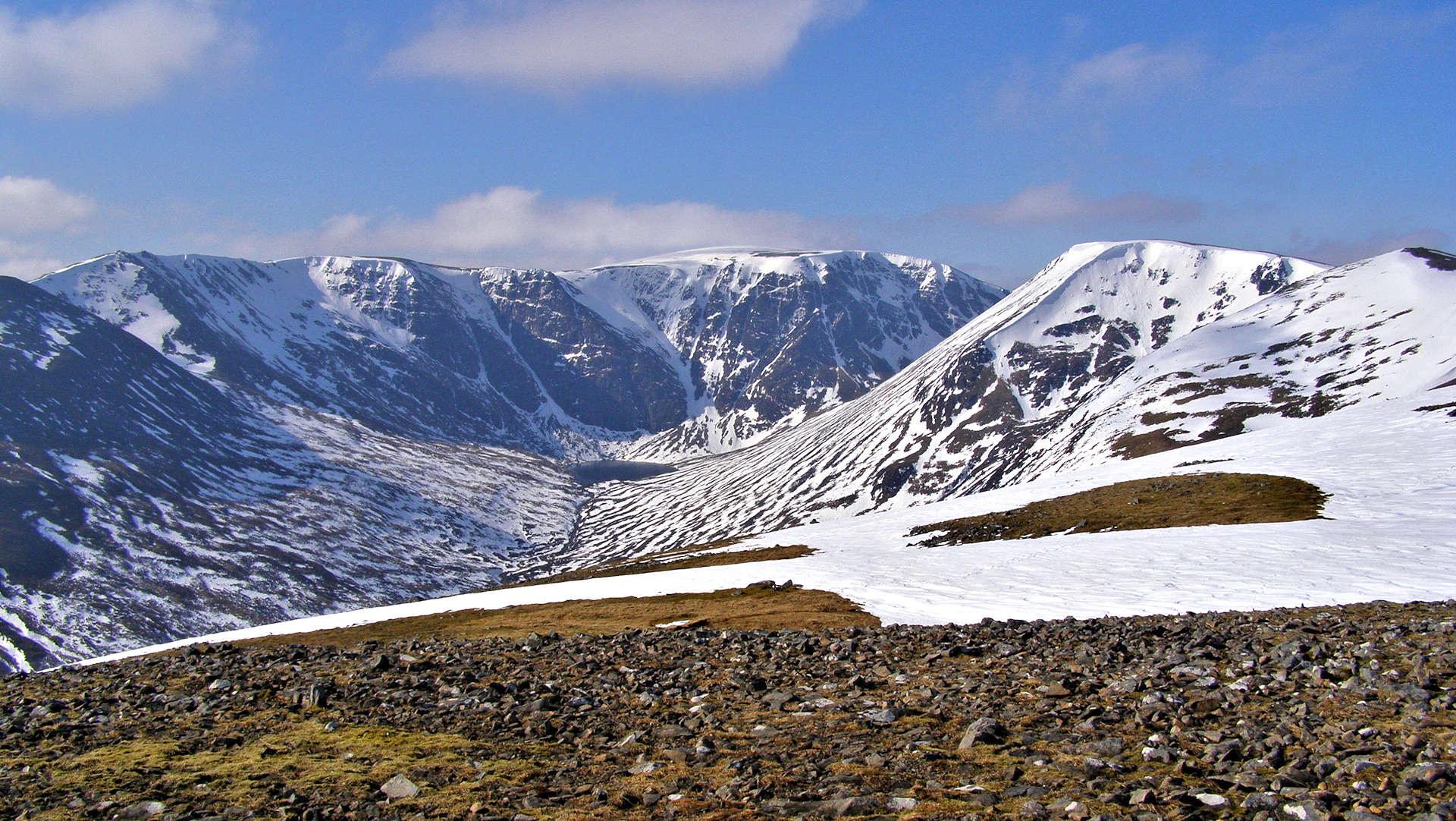
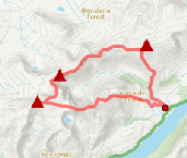
Creag Meagaidh is a vast and stunning mountain at the heart of a range of 5 Munro peaks in the Central Highlands also including Beinn Teallach, Beinn a' Chaorainn, Stob Poite Coire Ardair and Carn Liath. Starting and finishing on the A86 above Loch Laggan, this circular hillwalking route takes in all 5 summits.
Route outline
| Munros | ||||
| Ascent | 1850m (6060ft) | |||
| Distance | 27km (17m) | |||
| Time | 9:45hr | |||
| Start | Aberarder Grid Ref : NN483873 | |||
| Finish | Roughburn Grid Ref : NN377814 | |||
| Terrain |
| |||
| Nav |
| |||
| Effort |
| |||
| Scenery |
| |||


The route initially travels up from the NatureScot building at Aberarder towards Coire Ardair, with lots of wildlife hiding - but if you can't see any, there's often a herd of deer kept near the car-park and they're not camera-shy !
Heading up Carn Liath first, then hiking westwards towards Stob Poite Coire Ardair, the view to Creag Meagaidh and Coire Ardair with its spectacular cliffs is ever-changing. Beinn a'Chaorainn has some good summer scrambling up its east ridge and in winter has huge cornices on its eastern aspects - careful navigation is needed mist ! The walk is finished with lovely views over the Easains and Loch Treig as Beinn Teallach is gradually descended.
Show map
Route description
1. Getting to Aberarder and Roughburn

The NatureScot buildings at Aberarder
The A86 travels from Newtonmore to Spean Bridge, passing Loch Laggan on its way. Around halfway along Loch Laggan, the start point for this route is the large car-park for hillwalkers below the NatureScot buildings at Aberarder. The finish is at Roughburn, around 13km south-west of the start, so a good idea to have made some arrangements to avoid a walk back along the A86.
2. Carn Liath

Heading into woodland, looking up to Na Cnapanan and Carn Liath
From the car-park, head up towards the buildings at Aberarder  , where there's a shelter, a bench and some display boards with lots of interesting information on the terrain and wildlife in the area.
Follow a sign-posted route tracing a well constructed path around the right of the house, over a bridge, up to and past a wall to just before the birch forest of Coire Ardair.
As you begin to climb in the woodland, look for a small cairn  and a faint path heading off right (north-east) up over the heather and through the re-generating birch wood. The path can be pretty mucky !
Out of the woodland and further up the path levels out just to the west of the fine vantage point of Na Cnapanan  .
.
On the path, aim initially north-east around some steep ground, gradually turning north-west and hike up to Carn Liath's broad summit crest. The summit  and its large cairn are around 300m further on.
3. Stob Poite Coire Ardair

Heading to Stob Poite Coire Ardair
Although the summits can often be in cloud, the ridge between Carn Liath and Stob Poite Coire Ardair can often be clear. Just as well, as when in mist, carefully navigation from Carn Liath is needed, since the path is very faint.
Leaving Carn Liath's summit, head westwards to drop to a small nick  (Uinneag Coire a'Chaorainn) where the remains of an old wall can be found. Uphill over Meall an t-Snaim
  to another gap
  (Uinneag Min Choire) where the topography can be confusing in mist. Coming out of this gap, the path heads left (south-east), then turns right to reach Sron Coire a'Chriochairein
  and continue along the crests.
Fence-posts are picked up and followed up and along towards Stob Poire Coire Ardair. It's tricky watching your feet on the boulders, since the constant stunning view left over Coire Ardair to the winter climbs is awesome. There is a particularly superb view from a slight detour off the path, around 300m before reaching the summit.
There are two cairns on Stob Poite Coire Ardair's summit crest, the top 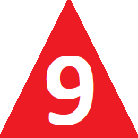 is the westerly of these.
4. Creag Meagaidh

Approaching Creag Meagaidh's summit from Mad Meg's Cairn
Leaving Stob Poite Coire Ardair's summit behind, continue following the path hugging the posts south-west and begin to lose height. The posts turn sharply and you might be tempted in mist to follow them - don't as they come to an abrupt halt above a 20m drop ! Keep to the path down to 'The Window'  (also known as Uinneag Coire Ardair) , then turn south-east, still following the path and start climbing uphill.
The path zig-zags up through some scree, then levels out - it's perhaps worth heading a bit east to look back down into Coire Ardair.
Following the path, it turns south-west and reaches 'Mad Meg's Cairn'  , a huge pile of stone that could be mistaken for Creag Meagaidh's summit in mist. Apparently it is the burial spot of an 18th century suicide who was denied a grave in the local cemetary.
Creag Meagaidh's not-so-large summit cairn 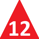 is a further 500m or so onwards, from where the views are wonderful.
5. Beinn a'Chaorainn

Cornice on Beinn a'Chaorainn
Leave the Creag Meagaidh's cairn and head south-west along its wide crest. After around 500m, you should pick up a line of wooden posts  to follow for around 1km to where they turn sharply right (north-west)
  . Leave them and continue west-south-west over pathless, grassy but easy terrain down to Bealach a'Bharnish
  .
.
Uphill next, south-west following the crest of Beinn a'Chaorainn's north-eastern shoulder. Higher up keeping to the rim of aim around Coire na h-Uamha, Beinn a'Chaorainn's North Top  , marked by a small cairn, is reached.
In winter, Beinn a'Chaorainn and Coire na h-Uamha are famed for huge ice cornices, and there have been several accidents here over the years, so keep well away from the edge in misty winter conditions.
From the North Top, the route to Beinn a'Chaorainn's main summit is obvious, following a path and the rim of Coire na h-Uamha to the summit cairn. Over the years there has been debate as to whether the Centre Top or South Top is the summit - at a height of 1052m, it's the Centre Top  !
!
6. Beinn Teallach

Beinn Teallach from Beinn a'Chaorainn
The easiest route to Beinn Teallach begins by returning to the Beinn a'Chaorainn's North Top , then heading north for a bit over some grass and boulders, before turning north-west downhill descending grassy slopes ground to drop 400m.
The bealach (marked Tom Mor) is reached, where there is a small memorial cairn  . Cross the bealach and begin uphill on the opposite side of the bealach.
Initially very wet, an obvious path is picked up and heads up Beinn Teallach's north-east shoulder. Higher up, the path is drier travels up to two cairns set 100m apart on Beinn Teallach's summit  - the first cairn met is the top. What this Munro lacks in height it more than makes up for in the way of stunning views.
7. Down to Roughburn

The Allt a'Chaorainn
The next part of the route depends on how in spate the Allt a'Chaorainn is ! Its used to crossable using a fence-wire with wooden slats at NN364826, however this is no longer possible as currently only the top part of the fence survives.
If river levels are low, then from the western cairn, initially head south on a faint path over dry bouldery ground. The ground becomes progressively more heather covered and the path more distinct as height is lost. Further down wet and grassy terrain is crossed to reach an old wire fence and join a more defined path/ATV track  .
Over this and continue on the now obvious path around some felled-forestry and cross the Allt a'Chaorainn a bit further downstream where the ground levels out
.
Over this and continue on the now obvious path around some felled-forestry and cross the Allt a'Chaorainn a bit further downstream where the ground levels out  just before it joins another river coming from the west.
If the Allt a'Chaorainn is likely to be in spate then from Beinn Teallach's summit re-trace your steps to the col at Tom Mor and head down a faint path on the eastern side of the Allt a'Chaorainn (there is a track on the west side of the burn, but it will need crossed lower down).
After 3km, you'll reach the other side of the forestry .
Through the deer-fence next via a stile or gate, then pick up a constructed path at the edge of more felled-forestry to reach a forestry track that heads down to Roughburn. Hopefully you've had the fore-thought to have placed car or bike in the car-park here that'll get you back to Aberarder !
Route profile »

Maps and GPX downloads »


|
Download GPX of route |
The map images above link to items on Amazon. A small commission is earned on any map purchased which helps fund the operating costs of this website.
Weather forecasts »
| Regional | MWIS - Western Highlands |
| Peak specific | Mountain Forecast.com Met Office YR.no |
| Seasonal | SAIS - Creag Meagaidh Midge forecast |
Alternative and nearby routes »
Creag Meagaidh and neighbouring Munros | |
|
In the Central Highlands, Creag Meagaidh is a vast and stunning mountain dominating the view northwards above Loch Laggan. Heading up Creag Meagaidh via Carn Liath and Stob Poite Coire Ardair makes for a superb circular route with options of returning down the skyline or heading through 'The Window'. Peaks : 3 Munros
Ascent : 1200m (3940ft) Distance : 19km (12m) Time : 6:45hr |
Ardverikie and Loch Laggan Munros | |
|
Lying between Laggan and Alder, the Ardverikie Forest is a wild area containing three Munro peaks, Beinn a'Chlachair, Geal Charn and Creag Pitridh. Peaks : 3 Munros
Ascent : 1350m (4430ft) Distance : 26km (16m) Time : 7hr |
Roughburn Munro Circuit | |

|
Above Glen Spean and west of the Creag Meagaidh massif, the two Munros of Beinn Teallach and Beinn a'Chaorainn combine to make a delightful hillwalking circuit. Probably best hiked in winter conditions to view the massive cornice that forms above Beinn a'Chaorainn's eastern corries. Peaks : 2 Munros
Ascent : 1215m (3990ft) Distance : 16km (10m) Time : 6hr |
Gairbheinn and Meall na h-Aisre | |

|
The undulating high moorland above the River Spey just east of the Corrieyairack Pass has several rolling hills, two of which are distinctive enough to justify Corbett status. Navigation skills will be tested on the high ground, particularly in misty conditions. Peaks : 2 Corbetts
Ascent : 900m (2950ft) Distance : 21km (13m) Time : 6:45hr |


