
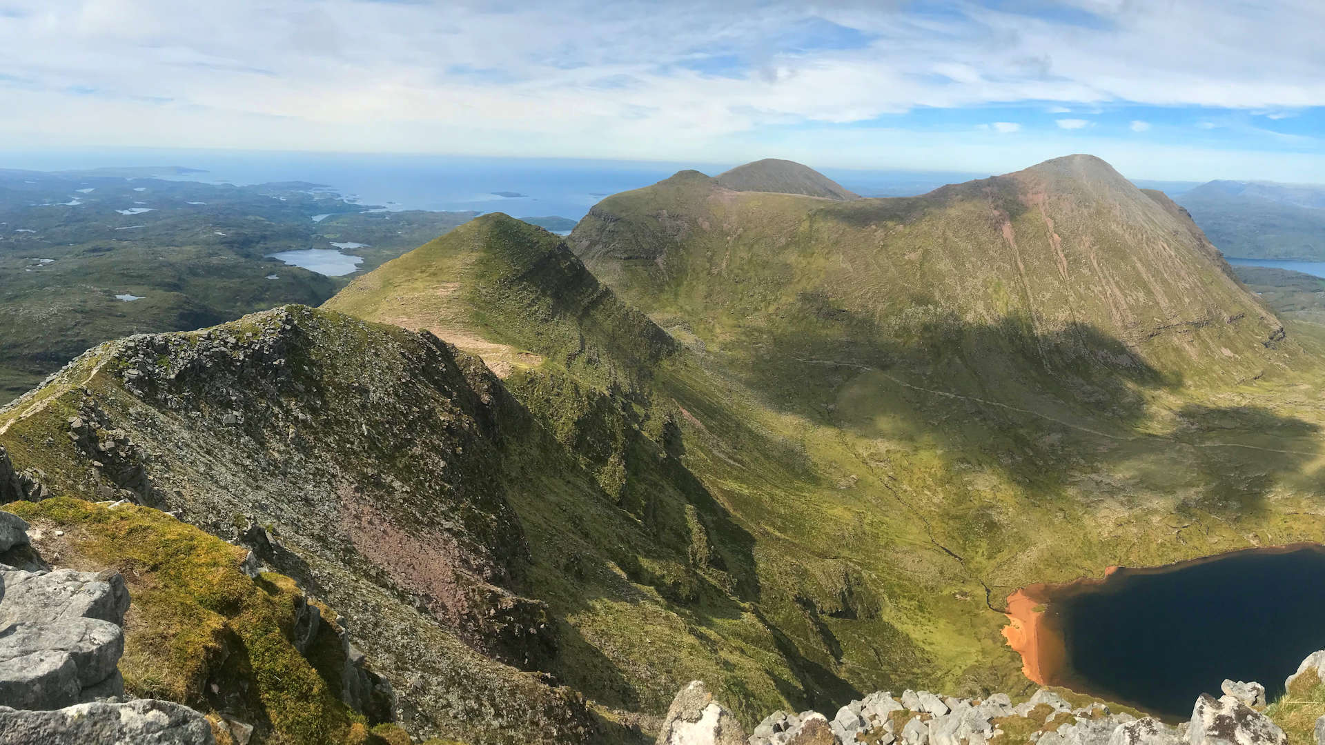
Quinag from above Loch Assynt
Hillwalking route bagging Spidean Coinich, Sàil Gharbh and Sàil Ghorm on Quinag. A superb route covering all 3 Corbett summits on this rugged massif.
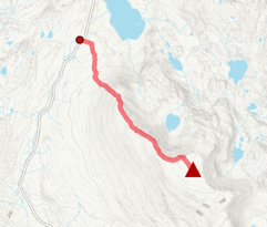
Route outline
| Corbetts | ||||
| Ascent | 1150m (3770ft) | |||
| Distance | 13km (8m) | |||
| Time | 5:10hr | |||
| Start/finish | Car park on A894, Loch Assynt Grid Ref : NC232274 | |||
| Terrain |
| |||
| Nav |
| |||
| Effort |
| |||
| Scenery |
| |||


Quinag looks quite impenetrable from most directions, but from the car-park on the A894 on the pass between Quinag and Glas Bheinn it is relatively straighforward to access the Corbett peaks.
A fine path from the car-park, much of which has seen upgrading in recent times, travels into the heart of the mountain, thereafter boot-worn paths lead up onto ridges and crests.
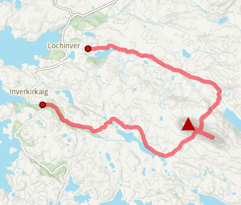
Show map
Route description
1. Getting to pass between Quinag and Glas Bheinn

Quinag from the car-park on the A894
North of Ullapool, Assynt is a vast landscape pitted with lochans overlooked by dramatic mountains. Quinag is the most northerly of these, standing between Loch Assynt and Kylesku.
The A894 travels over the pass between Loch Assynt and Kylesku and just below the highest point on this road, there is a rough car-park on its east side with room for around 10 to 15 cars.
2. Spidean Coinich

Heading up Spidean Coinich
From the car-park, cross the road and start on an old stalkers path.
A John Muir Trust sign with leaflets is followed by a bridge over the Allt Sgiathaig.
Beyond the bridge the path travels westwards and after climbing around 50m, the path splits  with the path off the left fork aiming south and being much fainter than that off right which aims west.
Take the left fork, which can initially be a bit wet, cross a burn  , turn south-west and begin to climb again.
Further on the path becomes drier as it climbs through the heather and over some rocky slabs and joins the south-east crest of Spidean Coinich.
Ahead a cairn  can be seen - this isn't the summit of Spidean Coinich, but a minor top at c620m.
On from this minor top, the path drops on bouldery ground to a small lochan  (not marked on the OS Landranger map), then climbs steeply to Spidean Coinich's summit
  .
This summit is a wonderful place to stop for a bit and take in the ridges and crests of Quinag.
.
This summit is a wonderful place to stop for a bit and take in the ridges and crests of Quinag.
3. Sàil Gorm

On the crest to Sàil Gorm
Beyond Spidean Coinich, an obvious path follows the crest north-west and drops to a small bealach with a lochan.
Above the lochans, traverse without any difficulty over a narrow summit  (marked 713m) and drop down steep grassy ground on a zig-zagging path to Bealach a' Chornaidh
  .
.
The path twists and turns as it climbs steeply up the northern side of Bealach a' Chornaidh - easier than it looks ! Another minor summit  is met at the western end of the mountain crest coming from Sàil Gharbh.
From here there are fine views over Kyelsku Bridge to Fionaven, Arkle, Ben Hope and afar.
Quinag from here appears similar in aspect and terrain to Beinn Alligin.
is met at the western end of the mountain crest coming from Sàil Gharbh.
From here there are fine views over Kyelsku Bridge to Fionaven, Arkle, Ben Hope and afar.
Quinag from here appears similar in aspect and terrain to Beinn Alligin.
Down to next bealach, there are some crags and rocky ledges on its western side that resemble Stac Pollaidh's or An Teallach's towers - an excellent vantage point.
The path climbs up and around the east side of next bump  to next gap, from where it's a gradual climb up a path on an ever widening crest to Sàil Gorm's summit
  and its untidy cairn.
Some fine views from here !
and its untidy cairn.
Some fine views from here !
4. Sàil Gharbh

Spidean Coinich and Suilven from Sàil Gharbh
On Sàil Gorm's summit, about turn and return to the gap just before the minor summit at the western end of the mountain crest coming from Sàil Gharbh.
Ahead you can choose to climb back up this minor top and then turn east, or skip some height by contouring around the minor top on the left (north-east).
Doing the latter will require some careful footwork as some of the ground is rather loose.
Both routes converge on Sàil Ghairbh's crest  , from where a faint path travels over pink sandstone.
Sandstone abruptly gives way to grey quartzite on Sàil Ghairbh's crest leading onto the summit
, from where a faint path travels over pink sandstone.
Sandstone abruptly gives way to grey quartzite on Sàil Ghairbh's crest leading onto the summit  , on which a trig point and cairn sit.
Superb views in all directions !
, on which a trig point and cairn sit.
Superb views in all directions !
5. Return

Descending Sàil Gharbh on Quinag
Return to the bealach between Sàil Gharbh and the minor top and look for a small cairn just off the crest on its south side. This indicates the start of a rough path to follow down towards Bealach a' Chornaidh.
The path takes a gentle line south-west to below Bealach a' Chornaidh  , then turns south-east to drop close to Lochan Bealach Cornaidh.
Now with a fine view to Glas Bheinn and Conival ahead, hike down the path as it gradually improves, heading direclty for the car-park.
Route profile »

Maps and GPX downloads »


|
Download GPX of route |

|
Open route in OS Maps |
The map images above link to items on Amazon. A small commission is earned on any map purchased which helps fund the operating costs of this website.
Weather forecasts »
| Regional | MWIS - Northwest Highlands |
| Peak specific | Mountain Forecast.com Met Office YR.no |
| Seasonal | Midge forecast |
Alternative and nearby routes »
Glas Bheinn from the Làirig Unapool | |
|
Hillwalking route up Glas Bheinn from Làirig Unapool. A short rough hike beginning at 250m, with superb views from the summit. Peaks : 1 Corbett
Ascent : 530m (1740ft) Distance : 6km (4m) Time : 2:25hr |
Assynt Munros from Inchnadamph | |

|
Hillwalking route up Ben More Assynt and Conival from Inchnadamph. The two highest Assynt peaks, with an optional extension over Corbett Breabag. Peaks : 2 Munros and option of 1 Corbett
Ascent : 1190m (3900ft) Distance : 16km (10m) Time : 6hr |
Beinn Leoid, Meallan a' Chuail and Meall an Fheur Loch | |

|
Hillwalking route up Beinn Leòid from Loch Merkland. Using fine stalker’s paths, this outing also bags Meallan a’ Chuail and Meall an Fheur Loch. Peaks : 1 Corbett, 2 Fionas
Ascent : 1175m (3850ft) Distance : 17km (11m) Time : 6:10hr |
Canisp from Loch Awe | |

|
Hillwalking route to Canisp from Loch Awe. A shorter approach than from Glencanisp Lodge, with few paths, but some fine rock formations along the way. Peaks : 1 Corbett
Ascent : 740m (2430ft) Distance : 13km (8m) Time : 4:30hr |
Suilven circuit | |
|
Hillwalking route up Suilven from Glencanisp and Kirkaig Falls. A superb circuit from Lochinver, combining Suilven’s ridges and the spectacular falls. Peaks : 1 Fiona
Ascent : 1425m (4680ft) Distance : 22km (14m) Time : 7:50hr |


