
Loch an Daimh Munros (and a Corbett)
Hillwalking route up Stùc an Lochain, Meall Buidhe and Cam Creag above Loch an Daimh. Remote peaks near Stirling and Perth, yet memorable.
Route outline
| Munros | ||||
| Corbetts | ||||
| Ascent | 1335m (4370ft) | |||
| Distance | 17km (11m) | |||
| Time | 6:40hr | |||
| Start/finish | Giorra Dam, Glen Lyon Grid Ref : NN512464 | |||
| Terrain |
| |||
| Nav |
| |||
| Effort |
| |||
| Scenery |
| |||


Giorra Dam at the eastern end of Loch an Daimh is a fine place to begin a hike up the Munros of Stuchd an Lochain and Meall Buidhe. With a mushy shoreline and no path to fine, probably best to bag these Munros on a there-and-back route. Cam Creag, the Corbett peak east of Meall Buidhe, can be tagged in as a grassy detour from this summit, adding around an hour or so into the route.
Both Munro peaks offer fine views from their summits - Meall Buidhe is an excellent vantage point to look over Rannoch and Stuchd an Lochain's summit cairn perched precariously above a craggy drop down to Loch an Daimh.
Show map

Route description
1. Get to Giorra Dam

Stùc an Lochain from Giorra Dam
Get to Glen Lyon from Killin to the south or Aberfeldy to the east, then head along an unclassified road towards Bridge of Balgie where there is a shop and tearoom.
Drive west along another unclassified and narrow road for 4km, to where there is a junction in the road.
Turn right and drive uphill and to the end of the road just below the Giorra Dam - deer will often be seen by the roadside.
There is ample roadside parking by a notice board, but be careful not to block access to the tracks or dam. The notice board indicates the preferred routes during the stalking season.
2. Stùc an Lochain

Stùc an Lochain's eastern shoulder looking to the Lawers range
From where you've parked, follow the road down to the bridge over the Allt Conait below the dam. Cross the bridge and head uphill to the southern end of the dam.
Just after where the road becomes a track, a small cairn  on your left marks the start of a wet path uphill.
After an initial short climb, the path levels until it reaches a point  directly above the boathouse.
At this point the path turns south-west and climbs steeply over mixed terrain - grass, bog, burns and loose scree.
directly above the boathouse.
At this point the path turns south-west and climbs steeply over mixed terrain - grass, bog, burns and loose scree.
Once the crest of the eastern arm of Creag an Fheadain is reached  , the path meets a line of fence-posts travelling east-west and this is followed to the cairn
  on the summit of this minor top.
The path and posts turn and drop to a bealach below Sròn Chona Choirein.
From this bealach, start up towards Sròn Chona Choirein, but notice the path veers west away from the fence-posts as the gradient easies - keep to the path rather than following the posts !
The path contours below Sròn Chona Choirein's summit and meets up with the fence-posts once more as the bealach below Stùc an Lochain is approached.
One final short pull is required to reach the small cairn  on Stùc an Lochain.
Fine views are to be had from this summit, paticularly west towards the Beinn Dòrain group.
on Stùc an Lochain.
Fine views are to be had from this summit, paticularly west towards the Beinn Dòrain group.
Stùc an Lochain may be written as Stuchd an Lochain on older maps
3. Return to Giorra Dam

Descending Stùc an Lochain
Don't be tempted to aim northwards directly to the lochside and return along the shore. If you do, you'll find the ground on Loch an Daimh's shoreline very soft between boulders making for tiring progress as your feet sink into the gravel and mud.
The ground above the shore is heather clad and pathless and just as rough.
Instead, I've found it best to simply retrace my steps returning by the route taken up.
4. Meall Buidhe

Cornice on Meall Buidhe's southern crest
There is a soggy path aiming from the base of the dam up to its northern end. However, a better (and drier) route starts from the notice board aiming uphill, which meets up with another track  which travels east-west - turn west and walk for around 400m to just above the dam. Here a cairn
  marks the beginning of a faint path heading uphill on grass-covered ground.
On this path walk uphill, there are a few wooden posts marking the route. The path becomes sodden and occasionally faint, the wooden posts that aided navigation are then left behind.
As heather is reached, the path splits - either branch will do, though I prefer to aim up on the western one. These paths lead to a short clamber up heather and onto a shoulder encircling Coire nam Miseach.
The faint paths turn north and converge. Now much drier underfoot, the path is now much more obvious.
Further on, the path merges with another coming from the east at around c830m  and climbs up a short, but fairly steep incline onto the southern end the plateau of Meall Buidhe, where there is a small cairn
  .
.
Following the plateau's crest a faint path can be traced all the way to Meall Buidhe's summit  with its substantial cairn and fine views.
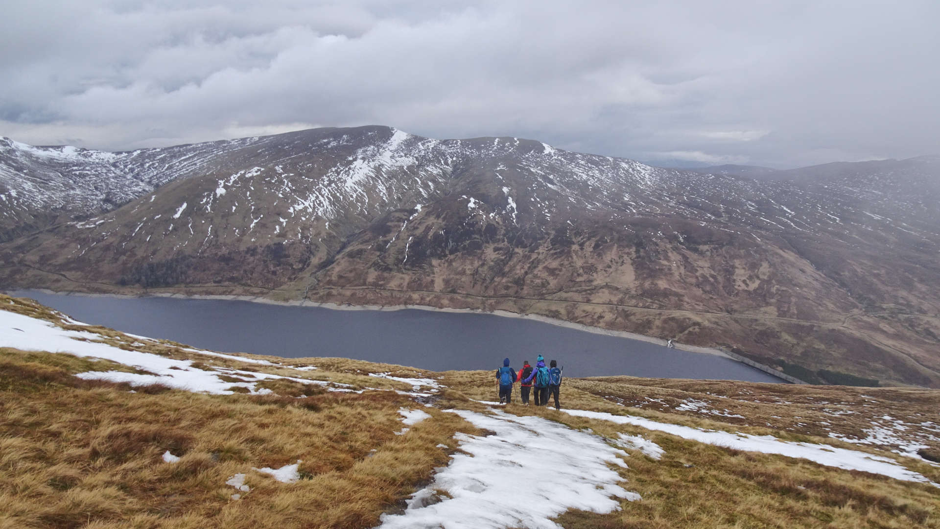
5. Return and detour to Cam Chreag

Returning along Meall Buidhe, looking to Stùc an Lochain
The most direct and straightforward return is to retrace your steps back to Giorra Dam.
A fine alternative is to detour via the Corbett Cam Chreag. To do this, begin by returning to the cairn at the southern end of Meall Buidhe's plateau.
Head east dropping to a bealach, then hike over the minor summit of Meall a' Phuill  .
Now on pathless slopes, drop eastwards on grass-covered slopes. As height is lost, terrain becomes more heather-clad and the bealach of Càrn Làirig Meachdainn
.
Now on pathless slopes, drop eastwards on grass-covered slopes. As height is lost, terrain becomes more heather-clad and the bealach of Càrn Làirig Meachdainn  is reached just after crossing a rough track.
A straightforward hike up grassy slopes gains the summit of Cam Chreag  on which stands an untidy cairn with a wooden post in its middle.
To return to Giorra Dam, begin by retracing your steps to Càrn Làirig Meachdainn , then pick up a rough ATV track heading southwards.
The ATV track becomes more distinct and meets up with the track heading east-west  , from where it's a leisurely stroll back to the notice-board.
Route profile »

Maps and GPX downloads »


|
Download GPX of route to Stuchd an Lochain |
|
|
Download GPX of route to Meall Buidhe |

|
Open route in OS Maps |
The map images above link to items on Amazon. A small commission is earned on any map purchased which helps fund the operating costs of this website.
Weather forecasts »
| Regional | MWIS - Southeast Highlands |
| Peak specific | Mountain Forecast.com Met Office YR.no |
| Seasonal | SAIS - Glencoe Midge forecast |
Alternative and nearby routes »
Innerwick Corbetts | |

|
Hillwalking route from Glen Lyon up Cam Chreag and Beinn Dearg, following estate tracks then short grassy climbs to the Corbett summits. Peaks : 1 Corbett
Ascent : 755m (2480ft) Distance : 13km (8m) Time : 4:30hr |
Glen Lyon Munros | |

|
Hiking route up the Munros north of Glen Lyon: Meall na Aighean, Càrn Mairg, Meall Garbh and Càrn Gorm, with option to extend to the Corbett Beinn Dearg nearby. Peaks : 4 Munros, option of 1 Corbett
Ascent : 1450m (4760ft) Distance : 17km (11m) Time : 6:40hr |
Beinn a' Chreachain and Beinn Achaladair from Loch Tulla | |

|
Hillwalking route from Achallader by Loch Tulla, climbing the Munros Beinn a’ Chreachain and Beinn Achaladair with superb views over Rannoch Moor. Peaks : 2 Munros, option of another Munro
Ascent : 1250m (4100ft) Distance : 15km (9m) Time : 5:50hr |
Beinn Dòrain and neighbours | |

|
Beinn Dòrain and four neighbouring Munros form a superb circuit above Bridge of Orchy, with options to split the route into shorter days. Peaks : 5 Munros
Ascent : 2560m (8400ft) Distance : 30km (19m) Time : 11:45hr |


