
Breabag and the Bone Caves
Hillwalking route up Breabag from the Bone Caves
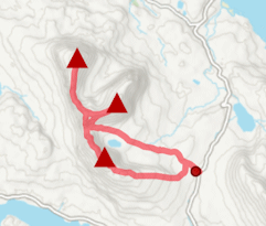
A hike of two halfs - fine paths on lower ground to the 'bone caves', followed by pathless grass and heather covered terrain to Breabag's summit crest.
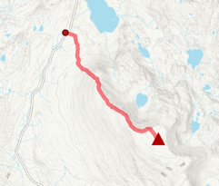
Route outline
| Corbetts | ||||
| Ascent | 700m (2290ft) | |||
| Distance | 10km (6m) | |||
| Time | 3:40hr | |||
| Start/finish | Allt nan Uamh, south of Inchnadamph Grid Ref : NC253179 | |||
| Terrain |
| |||
| Nav |
| |||
| Effort |
| |||
| Scenery |
| |||


Breabag is a rugged, long hill, its vast plateau covered in quartzite blocks. That said, grass or heather clad terrain can be found to hike up, with only the last 100m to the summit on boulderfield.
There are no paths on Breabag's slopes, but the approach from the car-park to the 'bone caves' is on decent paths and takes up half of the distance of a climb up this hill.
Show map
Route description
1. Getting to the Allt nan Uamh near Inchnadamph

Car-park by the Allt Uamh
In the north-west highlands, the A835 travels northwards of Ullapool to meet with the A837 at Ledmore Junction.
A couple of miles north of the junction, the road climbs and passes Loch Awe then begins to drop as it heads for Inchnadamph. A couple of kilometres north of the loch there is a parking area for the 'bone caves', and at my last visit, there was a small snack-van here selling coffee and sandwiches.
There are two parking areas - nearer the roadside there is room for around 10 vehicles and this is free, by the snack bar is privately owned and there is (at time of writing) a charge of £2, or £10 for overnight.
2. Breabag

Slabs on the way up Breabag
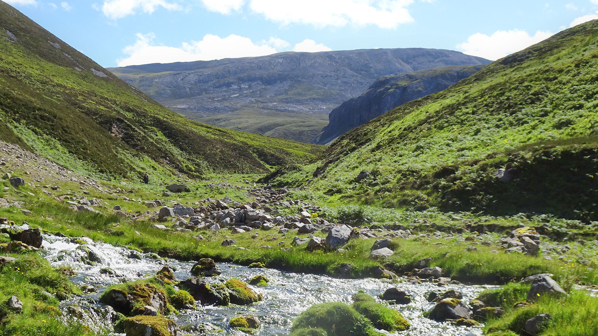
From the car-park, head through a gate, pass the coffee-shack and old remains of a fish farm and follow a well-defined path. The path turns and passes a lovely little waterfall  with the skyline of Breabag coming into view.
For the next 2km the path makes a route through grass and ferns to the base of the 'bone caves', on the way crossing the spring Fuaran Allt nan Uamh  and coming to a junction
  by a small cairn.
Assuming a visit to the 'bone caves' is to be made on the return, keep to the path on the northern bank of the Allt nan Uamh for another 1km or so. Cross the burn (wooden bridge) and then climb slightly to an indicator post  in a small corrie. The 'bone caves' path swings north-west, but instead leave it and continue south on a very faint path through grass.
At a convienient point, turn left (east) and climb slightly with Breabag's skyline coming back into view. Hike generally eastwards, aiming to the north of slabs  that can be seen ahead. There's a fair amount of plodding over heather and grass divits to reach higher ground, though occasional deer trods can be found to ease effort.

Breabag's summit looking south-west
 is on boulderfield. There's a small cairn on the summit with a bigger circular cairn slightly to the south. Superb views all round, including a terrific view of the Conival - Ben More Assynt crest.
Breabag's summit looking south-west
3. Return via the Bone Caves

In the 'bone caves' at the foot of Breabag
Return is by the same route.
Once the indicator post met earlier is reached, an interesting detour can be made to the 'bone caves'  before dropping to the Allt nan Uamh by the path junction and retracing steps back to the roadside.
Route profile »

Maps and GPX downloads »


|
Download GPX of route |
The map images above link to items on Amazon. A small commission is earned on any map purchased which helps fund the operating costs of this website.
Weather forecasts »
| Regional | MWIS - Northwest Highlands |
| Peak specific | Mountain Forecast.com Met Office YR.no |
| Seasonal | Midge forecast |
Alternative and nearby routes »
Assynt Munros from Inchnadamph | |

|
Ben More Assynt and Conival are the highest mountains in rugged Assynt in the north-west of Scotland. This route heads in from Inchnadamph to the west with the option to extend over the nearby Corbett of Breabag. Peaks : 2 Munros and option of 1 Corbett
Ascent : 1190m (3900ft) Distance : 16km (10m) Time : 6hr |
Canisp from Loch Awe | |

|
Of the two main approaches to Canisp, this is the shorter, but has little in the way of decent paths to follow. Some interesting rock formations are passed on route. Peaks : 1 Corbett
Ascent : 740m (2430ft) Distance : 13km (8m) Time : 4:30hr |
Glas Bheinn from the Lairig Unapool | |
|
Starting from a height of 250m, this short walk up rough terrain leads to Glas Bheinn's summit from where views are quite stunning. Peaks : 1 Corbett
Ascent : 530m (1740ft) Distance : 6km (4m) Time : 2:25hr |
Quinag from above Loch Assynt | |
|
Quinag is a stunning mountain with many crags and rocky terraces. This route bags all 3 Corbett peaks on Quinag - Spidean Coinich, Sail Gharbh and Sail Ghorm. Peaks : 3 Corbetts
Ascent : 1150m (3770ft) Distance : 13km (8m) Time : 5:10hr |


