
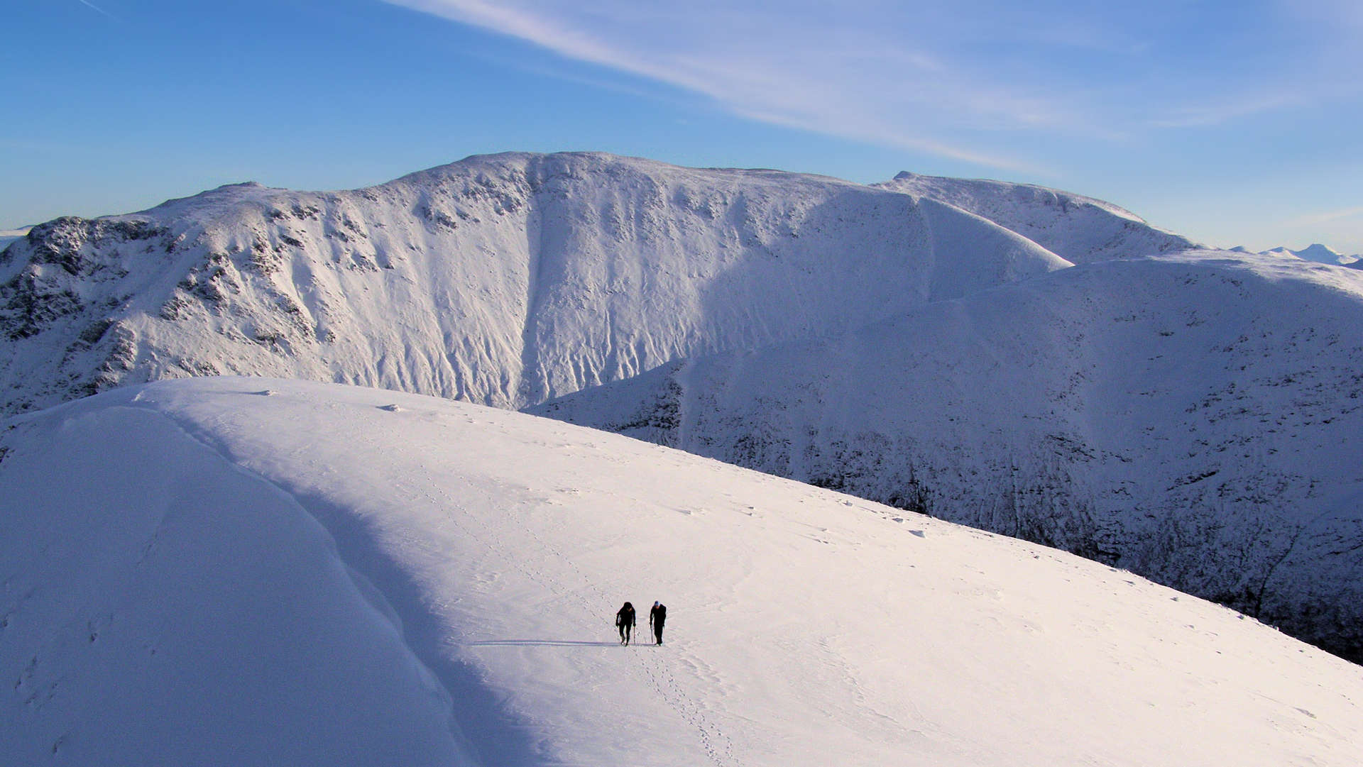
Creise
Creise is the highest point on a ridge running north-south above Glen Etive. Creise is most often bagged with nearby Meall a'Bhùiridh.
Creise
| Height | 1099.8m |
| Prominence | 169m |
| Meaning | narrow defile |
| Lists | Munros, 50 |
| Location | Above the Black Mount, Northwest Argyll and Appin |
| Grid Ref | NN238506 |
| Lat/Lon | 56.61429, -4.8725 |
South-east of Etive Mòr and Glen Etive, Creise is the highest point on a north-south ridge with rugged shoulders stretching in most directions.
Most often bagged with its slightly higher neighbour, Meall a' Bhuiridh, the most direct route heads up well defined paths from Glencoe Ski Resort. An alternative is to approach from Glen Etive hiking over Beinn Mhic Chrasgaig, which has the advantage of avoiding crowds of Glencoe Ski Resort.
The finest route however starts from Victoria Bridge and combines Creise and Meall a' Bhùiridh with Stob Ghabar and Stob a'Choire Odhair. This linear route on crests and ridges finishes at Glencoe Ski Resort, where a walk back along a section of the West Highland Way returns to the start.
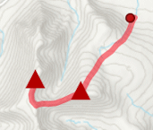
Routes up Creise
Black Mount Munros Traverse | |

|
Hillwalking route over Creise, Meall a’ Bhùiridh, Stob Ghabhar and Stob a’ Choire Odhair. A superb linear route from Victoria Bridge to Glencoe Ski Centre. Peaks : 4 Munros
Ascent : 1950m (6400ft) Distance : 20km (12m) Time : 8:15hr |
Meall a' Bhùiridh and Creise | |
|
Hillwalking route up Meall a’ Bhùiridh and Creise from Glencoe Ski Resort. A straightforward there-and-back climb of the two northern Munros of the Black Mount. Peaks : 2 Munros
Ascent : 1090m (3580ft) Distance : 10km (6m) Time : 4:20hr |
Black Mount mountains from Glen Etive | |

|
Hillwalking route from Glen Etive to Beinn Mhic Chasgaig, Creise and Meall a’ Bhùiridh. A tough there-and-back linking a Corbett with two Black Mount Munros. Peaks : 2 Munros
Ascent : 1500m (4920ft) Distance : 15km (9m) Time : 6:15hr |


