Glen Lochay Munros and Corbetts
Routes up Ben Challum, Beinn Sheasgarnich & neighbours
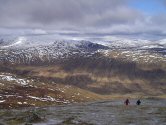
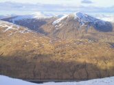
Between Glen Lyon and Glen Dochart, the peaks encircling Glen Lochay make for a grand day's hiking. There are 5 Munros and 2 Corbetts, all mainly grass covered, with only a few rocky sections encountered. Vast views from the summits, with that from Beinn Sheasgarnich's highest point being the finest in the range.Main route summary

Map base ©OpenStreetMap
The hills can be walked over 3 shorter days. Starting from Kenknock, Sgiath Chuil and Meall Glas can be done in one outing, with Beinn Sheasgarnich and Creag Mhor on another day. The route to do Ben Challum on it's own starts and finishes at Tyndrum. Details of these walks are in 'Alternative Routes' below.
In icy conditions Beinn Cheathaich's eastern side and Ben Challum's north-western arm can be slightly challenging. In mist getting to Beinn Sheasgarnich's summit will require some careful navigation.
Nearby Corbett Meall nan Subh requires only 300m of ascent to attain its summit if you drive up the Hydro road. Notice however that this road seems to be unmaintained and is now badly potholed and access is discouraged.
| Munros |
Sgiath Chuill (921m, Munro 269) Meall Glas (959m, Munro 198) Ben Challum (1025m, Munro 106) Creag Mhor (1047m, Munro 83) Beinn Sheasgarnich (1078m, Munro 62) |
| Corbetts |
Cam Creag (885m) Beinn nan Imirean (849m) Meall nan Subh* (804m) *see 'Alternative routes' |
| Ascent | 3140m (10,300ft) |
| Distance | 35km (22m) |
| Time |
walking : 11hr* running : 6hr *Naismith's rule : 4km/h distance + 600m/h ascent |
| Start/finish |
nr Kenknock farm
(grid ref : NN466364) |
| Profile | ||||
| Maps |
The map images above link to items on Amazon.
A small commission is earned on any map purchased which helps fund the operating costs of this website. More information on maps is on this page
|
|||
| Downloads |
Information on GPX files is on this page.
|
|||
| Terrain |
| |||
| Navigation |
| |||
| Effort |
| |||
| Scenery |
| |||
| Meanings | Creag Mhor : 'big crag' Beinn Sheasgarnich : 'sheltering hill' Meall Glas : 'green-grey hill' Sgiath Chuil : 'back wing (sheltering spot)' Ben Challum : 'Calum's hill' Cam Creag : 'crooked crag' Beinn nan Imirean : 'hill of the ridge' Meall nan Subh : 'hill of the raspberry' |
Route detail & map »
Photos of route »
Alternative routes »
Other hill routes nearby »
Forecasts & other useful info »


 with the Hydro road.
The large gates on the way are quite intimidating !
 , go through a gate, then at the edge of the forest, turn left on a faint path over wet ground to a small dam.
 .
.
 , which is a fine spot to photo Ben More and Stob Binnein from.
 .
.
 .
.
 and climb to Beinn nam Imirean's summit
  .
.
 .
.
 with its large cairn and great views.
 , follow the line of fences north uphill over grassy ground.
 .
.
 , aim north-east for ½km, then north, contouring around Stob nan Clach and reach the crest
  of the south-western arm of Creag Mhor.
 .
.
 below Sron Tairbh.
 is not far away.


