Home » Southern Highlands » Crianlarich
Crianlarich Munros
Routes up Ben More, Cruach Ardrain, An Caisteal & neighbours
Ben More and Stob Binnein are prominent landmarks from Scotland's Central Belt.
Ben More is a bulky hill from all directions, whereas Stob Binnein has a more defined, elegant shape with it's sliced-off top.
These two high peaks, combined with the five neighbouring smaller peaks to the west make for a fairly long but spectacular high-level route.
The peaks can be ticked off in smaller chunks over 3 days, for this, see 'Alternative Routes' below.
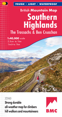
Note the route needs 3 different OS Landranger maps, 2 different OS Explorer maps, or just one of the Harvey maps !
Main route summary
There are four major dips in the route, with the last of these - the haul up Stob Binnein from the head of Benmore Glen - demanding all the strength that is left in your legs, having just done the five previous Munros.
Lower down, the hills are accessed via good tracks and paths, though depending on the weather, some of the ground can be saturated.
Higher up, most of the route across the ridges is on obvious paths.
Crossing the connecting dips however is done mostly over pathless grassy ground and will require navigation skills in mist.
| Munros |
An Caisteal (995m, Munro 147)
Beinn Chabhair (933m, Munro 244)
Beinn a'Chroin (942m, Munro 231)
Beinn Tulaichean (946m, Munro 220)
Cruach Ardrain (1046m, Munro 85)
Stob Binnein (1165m, Munro 18)
Ben More (1174m, Munro 16)
|
| |
| Ascent |
3400m (11,200ft)
|
| Distance |
30km (19m)
|
| Time |
walking : 13hr*
running : 6:20hr
*Naismith's rule : 4km/h distance + 600m/h ascent
|
| Start |
A82, 2km south of Crianlarich
(grid ref : NN370240)
|
| Finish |
Ben More Farm
(grid ref : NN415260)
|
Route detail & map »
Getting to to the start near Crianlarich
- Crianlarich lies at the junction of the A82 and A85 where the roads coming up from Glasgow and Stirling meet the road coming down from Fort William and Oban.
- The start of this route is from a long lay-by, 2km south-west of Crianlarich on the A82.
- The finish is at Benmore Farm, 3km east of Crianlarich, therefore a bike or shared transport would be helpful in cutting down the time on the return along the road.
An Caisteal
- From the lay-by, go through the gate, over a ence on your right and head south-east over a saturated field (often containing a bull and cattle).
- Now on the track, go under the rail-bridge and cross the wooden bridge over the River Falloch.
- Head up this track for around 1km to a burn, then turn south over more saturated ground to cross a fence and start to climb up gentle grassy slopes.
- Further up, the ascent steepens, the ground becomes drier and a path is picked up and followed south.
- The path is followed for 2km over a few bumps to a narrow bit, keep to the crest, don't be tempted by a path off left (east) - it will take you to more difficulties.
- The summit has a small cairn just a few minutes further on from this easy bit of scrambling.
Beinn Chabhair
- Leave An Caisteal and head south on the path and drop to around c910m.
- When the ground flattens, turn south-west and drop down on wet, grassy, steep ground to the bealach below.
- A faint path is picked up to cross the bealach and go around the lochan (not marked on the OS map), then start heading directly up Beinn Chabhair, initially following a burn.
- Easy, wet ground gives way to steep terrain further up, though no difficulties are encountered to reach the summit crest where a path is followed to the cairn.
Beinn a'Chroin
- Return to the bealach below An Caisteal, then head east-north-east over more wet, grassy, pathless ground up to the col between An Caisteal and Beinn a'Chroin.
- Once at the col, pick up and follow the path heading south-east.
- Errosion has taken it's toll on the path, but stick with it as it zigs, then zags around the western side of Beinn a'Chroin, then turns eastwards onto the tops.
- Over the years there has been a bit of debate over which part of this hill has the summit.
- The current OS maps marks the centre top with the highest spot height, thus indicating it as the summit.
- This highest point is just to the west of a small cairn overlooking a small lochan (not marked on the 1:50000, but marked on the 1:25000).
- The path heads over the tops to a cairn on the east top.
- The views from all the tops looking south are good, but from the eastern top, the views to Cruach Ardrain, Ben More and Stob Binnein are superb.
Beinn Tulaichean
- From the Beinn a'Chroin's eastern top head north on a faint path and drop around 200m to around c750m where a wide gully heads off down right.
- Go down this, cross the burn and drop to the wide bealach with some old iron fence-posts below Stob Glas.
- Cross this, and contour around the base of Stob Glas, over grass, boulders and a slabby ledge to reach the burn below Beinn Tulaichean.
- Head east up grassy ground to attain the broad ground connecting Beinn Tulaichean with Cruach Ardrain, then turn right (south-east) to reach Beinn Tulaichean's summit.
This is a fine point to look onto the three highest peaks on today's route.
Cruach Ardrain
- Return north-west and climb up Cruach Ardrain on the obvious path.
- Cruach Ardrain has two cairns with a slight dip between them.
The main summit is the north-east top, which has a large cairn sitting on it.
Excellent views from this.
Stob Binnein
- Head north-east from Cruach Ardrain's main summit, down steep ground on an obvious worn path that zig-zags through some loose ground to the safety of the bealach below.
- From this bealach turn east for 500m, dropping around 50m of height, then head north-east for 1km over wet grassy ground to the bealach below Stob Binnein.
- Don't head directly to the summit of Stob Binnein as higher up, the ground is just too steep to make for easy progress.
- Instead head for the northern arm of this mountain, around halfway between the summit and the bealach.
It's a fair slog up to this and once on the arm, it's still a climb up 150m.
- A suprisingly small cairn marks the top, but the views are wonderful.
Ben More
- Return down the northern arm of Stob Binnein, cross the bealach and head up Ben More via the obvious worn path.
- Further up there is one little awkward move just before reaching the flat top with its large cairn and trig point.
There's ground dug out around the trig point to shelter out of the wind.
When up here, you're on the highest peak south of Glen Dochart - this is a fantastic view point.
Return to Ben More Farm
- From the summit, head north-west, downhill on a worn path. Pick up an old wall and keep it on your left.
The ground becomes sodden the more height is lost.
- At around c350m a track coming out of Benmore Glen is picked up and followed down to Benmore Farm.
Just before the farm, at the gate, there is a stile to cross directly to the road, where hopefully you've arranged transport to get you back to the lay-by at the day's start.
Photos of route »

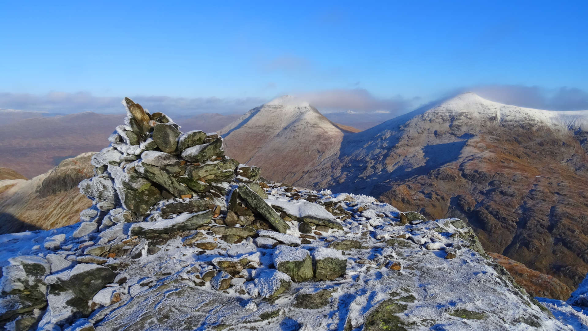
Stob Binnein and Ben More from a busy Tarmachan ridge

On Ben More's summit looking to Stob Binnein

The windy summit of Stob Binnein with Ben More behind

Approaching Stob Binnein from the south

Tulaichean and Cruach Ardrain from Bealach-eada-dha Beinn

Beinn Tulaichean from the eastern side of Cruach Ardrain

Beinn Tulaichean from Cruach Ardrain

Cruach Ardrain, Ben More and Stob Binnein from Beinn Tulaichean

On the way up the Twisting Hill, looking to Ben Lui

View eastwards from Beinn a'Choin's summit

An Caisteal and Beinn a'Choin from Beinn Chabhair

Beinn Chabhair from An Caisteal

Beinn Chabhair from Balquhidder Glen

Sunset over the Crianlarich Hills
More photos are on Flickr !
Alternative routes »
Ben More and Stob Binnein from the north »
Forestry tracks lead up to faint paths on this fine circuit.
Heading in from Balquhidder Glen »
This is probably the best route to take if you only want to get up the four easterly peaks in this range.
| Ascent |
2200m (7,200ft)
|
| Distance |
18km (11m)
|
| Time |
walking : 8:10hr
|
| Terrain | | easy |
 | difficult |
|
| Navigation | | easy |
 | testing |
|
| Effort | | stroll |
 | long day |
|
| Scenery | | ok |
| stunning |
|
- On the A84, 3km north of Strathyre, at a junction by Kingshouse Hotel, a road heads off to Balquhidder.
Take this road and follow to its end, some 12km, where there is a parking area by Inverlochlarig.
- Cross the road and over a stile into the field, then start climbing north up a worn, wet path.
The path improves further up and continues to Stob Coire an Lochain and onto Stob Binnein.
- Continue up to Ben More as already described, then return to Bealach-eada-dha Beinn, from where aim south-west to drop to the head of Benmore Glen.
- Climb up grassy ground around the base of Stob Garbh to the bealach between Stob Garbh and Cruach Ardrain, from where continue up a path to the summit of Cruach Ardrain.
- Leave the large summit cairn, then head south-west for 150m to another smaller cairn, then turn south on a path to head for Beinn Tulaichean.
- Aim south-east-south for 500m, then south to start losing height.
- Keeping slightly to the west will avoid the crags and at around c800m, turn south-east to drop to the farm.
- A track goes through the farm to take you back to the car-park.
This route can be extended to include the three westerly Munros in the group.
- From Beinn Tulaichean return to the col below Cruach Ardrain, then drop westwards on pathless and grassy ground and cross a couple of burns.
- Below some crags, contour around Stob Glas on more grassy ground and reach a bealach below Beinn a'Choin.
- Initally follow a burn uphill and gain the hill's northern spur and then the summit (it's the centre peak).
- Ignore the obvious path heading south-west and on a fainter path, drop westwards to the col before An Caisteal, then climb to its summit.
- Return 200m along the crest, then head south-west down steep grass covered slopes (no path) to the col below Beinn Chabhair.
- Head directly up to Beinn Chabhair's summit as described in the main route and return to the col.
- Turn south-east and drop to Balquhidder Glen to pick up a fine track to return to the car-park.
Interactive OS map »
The western three (or five) Crianlarich Munros »
A circuit returning along a fine crest.
| Ascent |
1615m (5,300ft)
|
| Distance |
16km (10m)
|
| Time |
walking : 6:45hr
|
| Terrain | | easy |
 | difficult |
|
| Navigation | | easy |
| testing |
|
| Effort | | stroll |
 | long day |
|
| Scenery | | ok |
| stunning |
|
- From the A82, west of Crianlarich, start as in the Main Route and climb up An Caisteal and Beinn Chabhair to Beinn a'Chroin.
- From the eastern top of Beinn a'Chroin, head north on a faint path along the shoulder of the hill.
- Further down the ground becomes pretty saturated, but the path continues and joins up with the track to take you back to the starting point.
- To include Beinn Tulaichean and Cruach Ardrain, follow the Main Route to Cruach Ardrain, then head north-west and follow a path down then over Meall Dhamh and the Grey Height.
- The path drops to the edge of a forest - don't take the path into the forest, as it's really horrible further down.
- Instead, follow the edge of the forest west down to the River Falloch, where an old bridge (unmarked on OS map) is used to cross the river, and meet up with the track going back to the A82.
- See extended green route on map below.
Interactive OS map »
Other hill routes nearby »

|
Glen Lochay circuit
A fine circuit taking in 5 Munros and 3 Corbetts. This route can be a serious undertaking, so perhaps split it into smaller chunks with the alternatives described
|
| |

|
The Lochearnhead Corbetts
Many different possiblilties for accessing these hills, but from Edinchip they can be combined into a fine circuit
|
| |

|
Ben Ledi and Ben Vane
Good access paths and fences to follow making for a popular route over these two hills near Callander
|
| |

|
Ben Lomond
The most southerly Munro. Can be very busy, so recommended doing first thing in the morning when quieter. The views are superb and there's a hill race up it too !
|
| |

|
Ben Lui group
A choice of good tracks in. With grassy ridges, an excellent runnable route over 4 Munros can be enjoyed on clear days.
|
Forecasts & other useful info »


