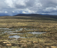
Ben Avon and neighbours from Linn of Quoich
Bike and hike route through Scots Pine forests up high plateaux and volcanic tors on the Munros Ben Avon, Beinn a' Bhùird, Beinn a' Chaorainn and Beinn Bhreac.
Route outline
| Munros | ||||
| Walk ascent | 1640m (5380ft) | |||
| distance | 34km (21m) | |||
| time | 11:15hr | |||
| Bike ascent | 100m (320ft) | |||
| distance | 16km (10m) | |||
| time | 1:00hr | |||
| Start/finish | Linn of Quoich, Braemar Grid Ref : NO174911 | |||
| Terrain |
| |||
| Nav |
| |||
| Effort |
| |||
| Scenery |
| |||
Excellent estate tracks make for a fine cycle and easy access through delightful Scots Pine forests into the heart of this area full of wildlife.
The unusual volcanic tors on Ben Avon will have you wandering all over the place to investigate with the main summit tor requiring an easy scramble to reach its highest point. Beinn a' Bhùird has huge cliffs with its summit marked by a tiny cairn standing on a vast plateau - requiring navigation skills in mist !
Beinn a' Chaorainn and Beinn Bhreac are slightly less interesting in comparison, identifying these on the landscapes when viewed from Beinn a' Bhùird or Ben Avon is not immediately obvious. Rough undulating moorland runs between the summits of these two Munros, progress over which can be tedious in mist.
It would be perfectly possible to add the wee Corbett of Càrn na Drochaide onto this route - see the Càrn na Drochaide from Linn of Quoich page for more information.
Show map
Route description
1. Getting to the start at Linn of Quoich

Hiking up Glen Quoich
From Braemar, drive west along its main street, then continue on an unclassified road for 9km to the bridge over the Linn of Dee.
Cross the bridge, turn sharp right and pass the large visitors car-park.
Continue along the narrow road for a further 5km to its end by Linn of Quoich where there is a car-park. There is a daily charge to park of between £5-£6 (depending on vehicle type) at tìme of writing (2025), though parking for members of the National Trust for Scotland is free.
The 'Punch Bowl', a narrow gorge in Quoich Water is worth having a look at.
2. Quoich Water

Cycling up Glen Quoich
Just before the bridge over Quoich Water, a path heads westwards uphill from the roadside and this is followed to meet with a track approaching from the south-west. Follow this track through beautiful Glen Quoich forest for 6km to where it fords Quoich Water  - if cycling in, leave bikes here.
Cross the river, which should be easy enough in normal conditions - to avoid getting wet feet, there are some handy boulders slightly upstream to bounce across on. On to the northern bank of the river, the track splits - take the right fork and follow it for just over 1km where it ends abruptly at the river's edge  .
.
Pick up a path and follow it aside the river bank. After around 2km, and out of the forest, the path drops down to cross Quoich water  .
.
3. Ben Avon - Leabaidh an Daimh Bhuidhe

North of Càrn Eas, the tors of Leabaidh an Daimh Bhuidhe comes into view
Cross Quoich Water (difficult in spate) to its eastern side, where the path connects with another coming in from Invercauld. This path turns northwards and is followed for around 2km to cross a burn below the base of Càrn Eas  .
.
A couple of options here - and steep on more gentle, but longer.
A direct, steep climb can be made up a pathless slope of stunted heather onto Càrn Eas  . This is followed by a crossing a wide, high-level plateau with Ben Avon's summit tor in view most of the way ahead,
Alternatively, the path can be followed around the base of Càrn Eas, to cross the Glas Allt Mòr and climb up a gentle rise to reach the weathered rocks at 'The Sneck'  - the bealach between Beinn a' Bhùird and Ben Avon - from where a hike up a twisting path reaches a plateau south-west of Ben Avon's summit.
The routes converge with Ben Avon's summit tor, Leabaidh an Daimh Bhuidhe  in view ahead and around 1km away.

Approaching Ben Avon's summit from the west

Approaching Ben Avon's summit from the west
4. Beinn a' Bhùird

The bealach between Ben Avon and Beinn a'Bhuird
From the Ben Avon's summit, return south-west and head down the zig-zagging path to 'The Sneck'  between Ben Avon and Beinn a' Bhùird.
Follow the worn path as it heads west and climbs up some scree. Higher up the ground levels with terrain becoming less stoney and more grass covered. In clear conditions, the route ahead is fairly obvious while aiming westwards, whereas in mist this section of the route will be navigationally testing !
Keeping to the left (south) of Cnap a Chleirich  , the minor top ahead, hike in a generally west direction for around 1km.

View from the North Top southwards
 marking Beinn a' Bhùird's summit on the broad and vast plateau. Due to the large flat area here, the best views are to be had by veering a few yards from the cairn !
View from the North Top southwards
5. Beinn a' Chaorainn

Beinn a'Chaorainn's summit cairn with Ben Macdui beyond
Standing on Beinn a' Bhùird, picking out Beinn a' Chaorainn in the view westwards is quite difficult, as Beinn Mheadhoin, Cairngorm and Bynack Mòr all tower above this apparently insignificant Munro !
From the cairn on Beinn a' Bhùird's North Top, aim westwards for around 1km down a gentle heather-clad slope with occasional short steep bouldery sections. The gradient levels and an occasional and indistinct path can be picked up.
Continuing west, pass some lochans  , cross a burn and aim directly over heather then bouldery ground up towards Beinn a' Chaorainn. If you fancy a slight de-tour, then Beinn a' Chaorainn Beag
  and its lochans are worth a visit.
Reaching Beinn a' Chaorainn's summit  , there's a large cairn from where fine views are to be had on clear days to the surrounding higher peaks of the Cairngorms.
6. Beinn Bhreac

Beinn Bhreac from Beinn a' Chaorainn
Just 5km of grass-covered moorland separates Beinn a' Chaorainn from Beinn Bhreac, but crossing its damp and undulating terrain can feel a bit of a tedious slog !
Initially on a worn path through scree, descend from Beinn a' Chaorainn's cairn aiming southwards. As the path becomes more indistinct, begin turning south-east and drop to the flat Moine Bhealaidh.
The terrain now grassy underfoot, is interspersed with occasional wet peat hags and burns that can be rough test for ankles. Beyond the peat hags, a faint path can be picked up to follow southwards.
As this path begins to rise gentle uphill, it becomes more distinct before ending up on the stoney ground between the two tops on Beinn Bhreac - turn east over a minor rise to reach the cairn on Beinn Bhreac's main summit  . Nice views south !
7. Return to Linn of Dee

Descending Beinn Bhreac into Glen Quoich
Heather clads the ground south-east of Beinn Bhreac and it's steep initially too ! Persist and a direct descent is made into a lovely Caledonian Scots Pine forest to then follow the Allt an Dubh-ghlinne back to the crossing on the River Quoich made earlier in the day  .
.
Rather than aiming directly down to Glen Quoich, an alternative and easier route begins by following a faint path through bouldery ground from Beinn Bhreac's summit aiming southwards to a narrow gap. A gentle climb up Meall an Lundain  is made from where, a turn east-south-east leads downhill to follow the edge of a felled forest to Quoich Water
  .
.
Pick up your bike and enjoy the cycle back to Linn of Quoich.
Route profile »

Maps and GPX downloads »

|
Download GPX of route |

|
Open route in OS Maps |
The map images above link to items on Amazon. A small commission is earned on any map purchased which helps fund the operating costs of this website.
Weather forecasts »
| Regional | MWIS - Cairngorms and Monadhliath |
| Peak specific | Mountain Forecast.com Met Office YR.no |
| Seasonal | SAIS - Northern Cairngorms Midge forecast |
Alternative and nearby routes »
Ben Avon and Beinn a' Bhùird from Tomintoul | |

|
A delightful cycle through Glen Avon is followed by hiking paths on gentle slopes to pass weird rocky tors to reach the summits of Ben Avon and Beinn a' Bhùird. Peaks : 2 Munros, option of 1 Fiona
Ascent : 1600m (5250ft) Distance : 51km (32m) Time : 10:30hr |
Càrn na Drochaide from Linn of Quoich | |

|
A delightful hillwalking circuit on tracks and faint paths above the forests surrounding Linn of Quoich to cross Càrn na Criche on the way to Càrn na Drochaide. Peaks : 1 Corbett
Ascent : 515m (1690ft) Distance : 9km (6m) Time : 3:10hr |
Culardoch and Creag an Dail Bheag from Tomintoul | |

|
Some easy trail-biking leads to the base of Culardoch and Creag an Dail Bheag from where a couple of short there-and-back hikes bags these two Corbett hills. Peaks : 2 Corbetts
Ascent : 1230m (4040ft) Distance : 53km (33m) Time : 6hr |
Sgòr Mòr from Linn of Dee | |

|
A hike from Linn of Dee up heather-clad slopes aside fence posts to the summit of isolated Sgòr Mor, from where superb views are had of the Cairngorms. Peaks : 1 Corbett
Ascent : 650m (2130ft) Distance : 18km (11m) Time : 5:30hr |
Morrone from Braemar | |

|
A short hillwalk from Braemar up a fine, if rather rough path to the top of Morrone - a superb viewpoint to survey the southern Cairngorms. Peaks : 1 Corbett
Ascent : 480m (1570ft) Distance : 6km (4m) Time : 2:25hr |


