
West of Drumochter Munros
Hillwalking route up Beinn Udlamain and Munros west of Drumochter, a quick high-level round of 4 summits with option to add the Sow of Atholl.
Route outline
| Munros | ||||
| Corbetts | ||||
| Ascent | 1300m (4260ft) | |||
| Distance | 24km (15m) | |||
| Time | 8:10hr | |||
| Start/finish | Balsporran Cottages, Dalwhinnie Grid Ref : NN627792 | |||
| Terrain |
| |||
| Nav |
| |||
| Effort |
| |||
| Scenery |
| |||


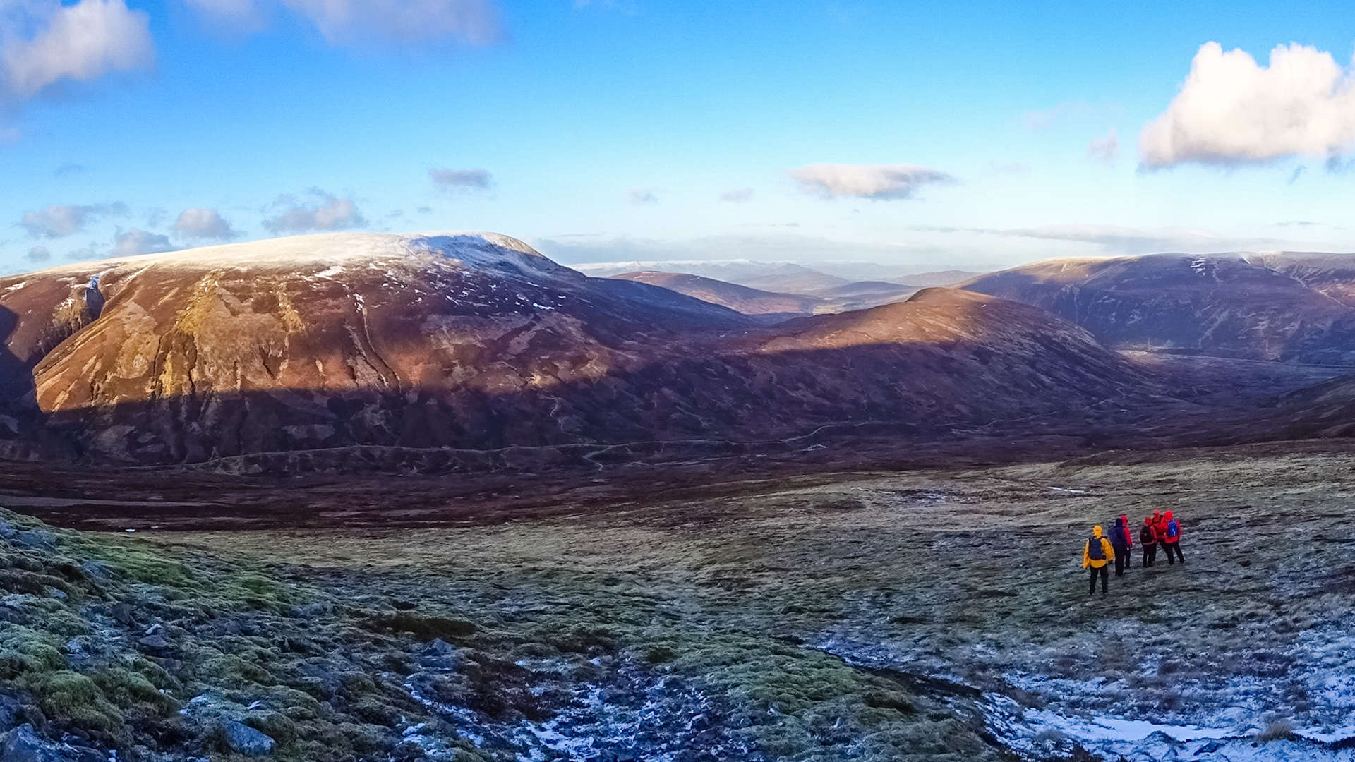
Terrain is fairly easy underfoot, with most of the route on paths and following fence-posts. On the wide summits of A' Mharconaich and Sgàirneach Mhor, navigation can be testing if mist or white-out conditions persist. On fine days all summits afford good views, paticularly over Loch Ericht to the Ben Alder group and beyond.
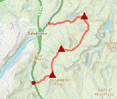
Show map

Route description
1. Getting to Drumochter and Balsporran Cottages

Geal-Chàrn above Balsporran Cottages
These hills are best accessed from Balsporran, by the A9, 4km south of Dalwhinnie, where there is ample parking.
The hill-route finishes in Drumochter Pass, around 4km south of Balsporran Cottages, therefore having a bike left at the end point or organising transport will avoid an unpleasant walk on the cycle route which hugs the A9 all the way back !
Balsporran Cottages is a bed and breakfast (search for Balsporran Cottages B&B)
2. Geal-charn

Cairns on Geal-charn's crest
From Balsporran Cottages cross over the the railway line using the level-crossing  , then begin to follow a track uphill.
Cross a burn via stepping stones, then another using a wooden bridge and just bit further on, the track splits into two  - take right fork. The track unfortunately doesn't last and suddenly you'll be jumping around trying to avoid the wet marshy ground. Follow the wet and peat-boggy path uphill.
Things do improve further up. On approaching c840m, the ground levels out and becomes more stone and gravel covered. There used to be a group of cairns  looking down on the A9, but these are now mostly gone.

Nearing Geal-Chàrn's summit
 (I think it's the first one !). Excellent views down Loch Ericht.
Nearing Geal-Chàrn's summit
3. A' Mharconaich

Heading to A' Mharconaich
Leave the Geal-Chàrn's cairn and head south-west over stone and boulders following a faint path downhill. Further down, the path becomes more obvious, turns south and at the bealach  between Geal-Chàrn and A' Mharconaich and meets with a track coming directly up from Balsporran.
Cross the bealach, then take a minor path that starts to climb off to left (south-east, there is sometimes a cairn marking the start point of this). At first this path is well constructed with stone steps, but gradually fades into a worn path. Follow this uphill over grass and occasional burn to A' Mharconaich's wind-swept crest.

Approaching A' Mharconaich's summit, Meall Chuaich beyond
 , the second is a small shelter out of westerly winds.
Approaching A' Mharconaich's summit, Meall Chuaich beyond
4. Beinn Udlamain

Beinn Udlamain from the western shoulder of A'Mharconaich
On A' Mharconaich about-turn, follow the path and line of posts along the mountain's crest south-west down to a small bealach above Fraoch-choire.
Uphill next and mainly on grass, continue following the path and posts. A minor bump is by-passed, thereafter the posts lead to a small cairn at the northern end of Beinn Udlamain's crest. A sharp turn left (south) and the posts lead to the summit of Beinn Udlamain  .
.

View from Beinn Udlamain down Loch Ericht
View from Beinn Udlamain down Loch Ericht
5. Sgàirneach Mhor

On Sgàirneach Mhòr's summit plateau
Leaving Beinn Udlamain's summit behind, continue following fence posts south, initially on grass, then stones and boulders. As the bouldery terrain eases briefly, look for evidence of a path forming off to the left at around the 900m contour  . Take this path as is drops through heathery ground, aiming south-east to end up crossing a small burn at the bealach between Beinn Udlamain and Sgàirneach Mhòr.
The path disappears into grass and peat, reforming higher up and continuing up to a small upright cairn  (NN589732) on the north-western end of Sgàirneach Mhòr's western arm (though with a bit of careful navigation, this dog-leg can be by-passed).

Looking south from Sgàirneach Mhòr to Meall nan Leitreach
 .
.Looking south from Sgàirneach Mhòr to Meall nan Leitreach
6. Sow of Atholl and return

Bridge over the Allt Coire Dhomhain
From Sgàirneach Mhòr's trig point, start to head east, downhill on a faint path. The path keeps to the crest of Sgàirneach Mhòr's eastern shoulder above Coire Creagach and drops to a gap just before reaching a small bump  (marked 758 on OS maps).
If not intending to climb the Sow of Atholl, look for a worn path heading northwards around the bump. This path travels around the bump on its north-facing slope, from where it's left behind for a direct fast descent to a bridge over the Allt Coire Dhomhain  (at NN620750 and not currently marked on OS maps).
If aiming up the Sow of Atholl, from the gap, pick up an obvious set of ATV tracks heading south-east to follow to a bealach  below the Sow of Atholl. Head directly uphill, north-east over patchy heather - it's a mere climb of just over 150m to the Sow of Atholl's summit
  . Leaving the summit behind, drop northwards down more heathery clad steep slopes to pick up another set of ATV tracks that lead to a bridge (at NN621749 and not shown on OS maps) to cross a burn and reach the bridge over the Allt Coire Dhomhain .

On the track out, looking back up to Sgàirneach Mhor
 . Join Route 7 cycle way to return to the A9 - if you've not left a bike or other transport near here, follow the cycle track northwards back to Balsporran Cottages.
On the track out, looking back up to Sgàirneach Mhor
Route profile »

Maps and GPX downloads »


|
Download GPX of route |

|
Open route in OS Maps |
The map images above link to items on Amazon. A small commission is earned on any map purchased which helps fund the operating costs of this website.
Weather forecasts »
| Regional | MWIS - Southeast Highlands |
| Peak specific | Mountain Forecast.com Met Office YR.no |
| Seasonal | SAIS - Creag Meagaidh Midge forecast |
Alternative and nearby routes »
Beinn Mholach from Dalnaspidal | |

|
Biking and hiking route up Beinn Mholach from Dalnaspidal. Cycle along Loch Garry then hike heather slopes to the wide crest and huge summit cairn. Peaks : 1 Corbett
Ascent : 620m (2030ft) Distance : 23km (14m) Time : 4:30hr |
Meall na Leithreach from Dalnaspidal | |

|
Hillwalking route up Meall na Leitreach from Dalnaspidal. A short direct route with just 450m of ascent, extendable into a more varied circular hike. Peaks : 1 Corbett
Ascent : 475m (1560ft) Distance : 13km (8m) Time : 4hr |
East of Drumochter | |
|
Linear hillwalking route over Càrn na Caim, A’ Bhuidheanach Bheag and Meall Chuaich east of Drumochter. Transport helps as start and finish are 11km apart. Peaks : 3 Munros
Ascent : 1100m (3610ft) Distance : 25km (16m) Time : 8:10hr |
Stob an Aonaich Mhòir from Loch Rannoch | |

|
Biking and hiking route up Stob an Aonaich Mhòir from Loch Rannoch. Cycle a hydro road then hike just over 1km on grass and heather to the summit. Peaks : 1 Corbett
Ascent : 690m (2260ft) Distance : 30km (19m) Time : 3:10hr |


