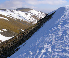
Meall na h-Aisre
Meall na h-Aisre, a remote Corbett at the west end of the Monadhliath, has views north spoiled by power works, though these developments also ease access.
Meall na h-Aisre
| Height | 862m |
| Prominence | 155m |
| Meaning | hill of the defile |
| Lists | Corbetts (C73) |
| Location | Glen Doe and Corrieyairack Pass, Monadh Liath to Glen Roy |
| Grid Ref | NH515000 |
| Lat/Lon | 57.06742, -4.45036 |
At the western end of the Monadhliath, Meall na h-Aisre is a fairly remotte and featureless Corbett hill. Recent man-made intrusions caused by electrical pylon installation and construction of the Stronelairg windfarm and Glendoe dam do blight the views north and north-west, but also make for easy and quick access !
The most obvious choice of route would be from the Old Military Road running alongside the River Spey, from where a quick hike up a bulldozed track reaches close to Meall na h-Aisre's summit.
Adding in Gairbeinn to the west of Meall na h-Aisre makes for a fine circular route with fairly challenging navigation over the moorland between the summits should mist be down.
Routes up Meall na h-Aisre
Gairbheinn and Meall na h-Aisre | |
|
Hillwalking route over Gairbheinn and Meall na h-Aisre - the Corbetts on the moorland east of Corrieyairack Pass and above the upper Spey. Peaks : 2 Corbetts
Ascent : 900m (2950ft) Distance : 21km (13m) Time : 6:45hr | |
Nearby hills and mountains


